










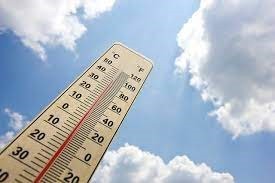
Chattooga County residents are advised to prepare for a prolonged period of warm, humid conditions punctuated by daily chances of afternoon and evening showers and thunderstorms from Monday, August 18th, through Thursday, August 21st. The forecast also highlights significant heat concerns.
High temperatures are expected to consistently reach the low to mid-90s, with overnight lows hovering around 70 degrees, offering little respite from the daytime heat. The most significant heat will be felt early in the week. The week kicks off with the most intense heat.
Monday, August 18th, will see mostly sunny skies with highs soaring into the mid-90s. Light northeast winds will prevail. Forecasters warn that heat indices could soar to between 97 and 102 degrees, making it feel significantly hotter. Overnight, it will be mostly clear with lows in the lower 70s.
As the week progresses, the chance of precipitation increases, potentially offering slight relief from the most extreme heat indices.
- Tuesday, August 19th: Expect mostly sunny conditions with a 30% chance of afternoon showers and thunderstorms. Highs will be in the lower 90s, with light easterly winds. Nighttime remains mostly clear, lows in the lower 70s.
- Wednesday, August 20th: Sunny conditions are forecast with an increased 40% chance of afternoon showers and thunderstorms. Highs will remain in the lower 90s. Winds will shift from light southeast to north around 5 mph in the afternoon. Overnight, it will be partly cloudy, clearing to mostly clear, with lows in the lower 70s.
- Thursday, August 21st: Forecasts mostly sunny skies and maintains a 40% chance of afternoon showers and thunderstorms. Highs will be around 90 degrees. Overnight, partly cloudy conditions are expected, with lows around 70 degrees.
Residents are urged to take precautions against the heat, including staying hydrated, wearing light clothing, and limiting strenuous outdoor activities, especially during peak afternoon hours. When thunderstorms develop, which are likely to be isolated but potentially strong, residents should seek immediate shelter. Continued monitoring of local weather alerts and river conditions is advised throughout the week.
Comments