






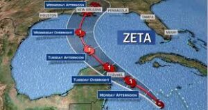
Zeta is the 27th named storm of the 2020 Hurricane season and, when it strikes the U.S. mainland Wednesday, it is expected to break a record by becoming the 11th named storm to do so in one year, according to forecasters. The storm has already battered Mexico and is expected to make landfall on the Gulf Coast today.
According to predictions from the National Weather Service, the storm will decrease in force by the time it reaches Northwest Georgia, but major amounts of rain can be expected. Forecasters are estimating that the heaviest rains will begin around 7 AM Eastern Tim on Thursday in Northeast Alabama and Northwest Georgia.
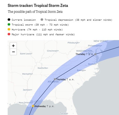
Today, rain will continue across the area with showers and thunderstorms; between a half and three-quarters of an inch of rain is possible. Then tonight through Thursday showers and thunderstorms will likely produce heavier amounts of rain across the region. Wind speeds could reach 35 mph in some places.
Overall, we could see between 2-3 inches of rain. A Flash Flood Watch remains in place.
After the rain moves out on Thursday night, we will see cooler temperatures and by the weekend we could have lows in the mid to upper 30’s.
The forecast for today from the National Weather Service in Peachtree City, Georgia for Chattooga County and Northwest Georgia:
Comments