


Northwest Georgia is bracing for a combination of oppressive heat and daily chances of scattered thunderstorms, beginning this afternoon and expected to persist through the week. Residents should prepare for gusty winds, heavy rainfall, and frequent lightning as high temperatures and soaring heat index values create favorable conditions for convection.
The region is experiencing hot and humid conditions this afternoon, with isolated to scattered thunderstorms anticipated to develop throughout the afternoon and evening. These storms, fueled by daytime heating and atmospheric destabilization, carry the potential for gusty winds, heavy rainfall, and frequent lightning strikes.
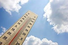
Today’s Forecast: Sizzling Heat and Afternoon Storms Today, skies will be mostly sunny, but the heat will be intense, with a high temperature near 91 degrees Fahrenheit. The “real feel” will be significantly higher, with heat index values soaring as high as 99 degrees. The chance of precipitation stands at 60%, with showers and thunderstorms most likely between 2 PM and 3 PM. New rainfall amounts are expected to be between a tenth and a quarter of an inch, though higher amounts are possible in more intense thunderstorms. Winds will be calm, becoming west around 5 mph in the afternoon.
Tonight’s Outlook The chance of showers and thunderstorms decreases to 20% before 9 PM. Skies will remain mostly cloudy, and the low temperature will settle around 73 degrees. A southwest wind around 5 mph will become calm in the evening.
Extended Forecast: Persistent Heat and Daily Storm Threat
- Tuesday: The pattern of heat and afternoon storms is expected to continue. The high temperature is forecast to reach an even hotter 93 degrees, pushing heat index values up to a sweltering 100 degrees Fahrenheit. The chance of scattered showers and thunderstorms rises to 50% after 2 PM. Tuesday night sees a 30% chance of showers and thunderstorms before 8 PM, with a low around 73 degrees.
- Wednesday: Looking ahead, Wednesday is forecast to be mostly sunny with a high near 92 degrees, and a 20% chance of afternoon thunderstorms after 2 PM.
The extended forecast indicates that Northwest Georgia will remain in the grip of above-average temperatures, with highs consistently in the mid-80s to 90s through the long term. Even more concerning are the projected heat index values, which are likely to range from 95 to 105 degrees through Friday, potentially climbing even higher into the upcoming weekend.
Residents are advised to stay hydrated, seek shade during peak afternoon hours, and avoid strenuous outdoor activities. Those spending time outdoors should also be aware of the potential for sudden thunderstorms and seek immediate shelter at the first sign of lightning.
Contact: [Your Name/Outlet Name] [Your Email/Contact Info]
Comments