


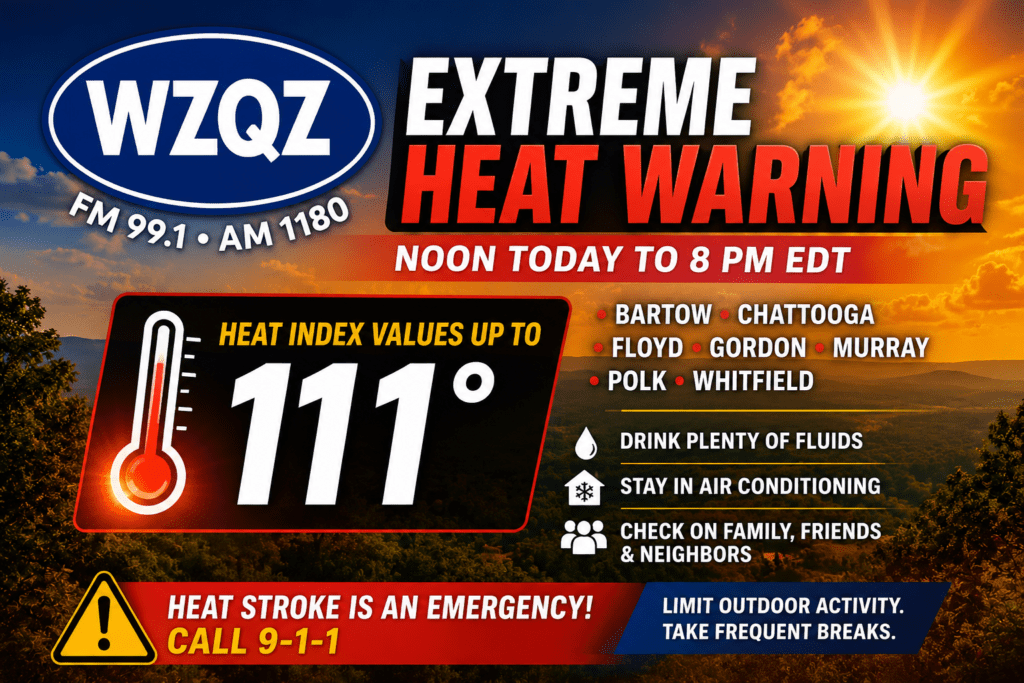
Dangerous and potentially life-threatening heat is expected across Chattooga County and much of Northwest Georgia today as an Extreme Heat Warning remains in effect from noon until 8 p.m.
The National Weather Service says heat index values could climb as high as 111 degrees this afternoon across Chattooga, Floyd, Gordon, Bartow, Murray, Polk, and Whitfield counties. The combination of temperatures near 98 degrees and very high humidity will create hazardous conditions for anyone spending extended time outdoors.
Forecasters say heat-related illnesses become much more likely during periods of extreme heat and high humidity. Residents are urged to drink plenty of water throughout the day, remain in air-conditioned buildings whenever possible, stay out of direct sunlight, and check on elderly neighbors, young children, and anyone without adequate cooling.
Those who must work or spend time outdoors should wear lightweight, loose-fitting clothing, schedule strenuous activities during the early morning or evening hours, and take frequent breaks in shaded or air-conditioned locations. OSHA also recommends regular rest periods for outdoor workers during extreme heat. Anyone showing signs of heat exhaustion should be moved to a cool location immediately. Heat stroke is a medical emergency—call 911 without delay.
There is a 30 percent chance of scattered afternoon and early evening thunderstorms after 5 p.m. While many communities will remain dry, any storms that develop could produce brief heavy rainfall, frequent lightning, and gusty winds before dissipating after sunset. Tonight will become partly cloudy with a low around 75 degrees.
The hot pattern continues into Friday, with another mostly sunny day and a high near 98 degrees. Only a slight chance of an afternoon thunderstorm is expected, and heat index values will once again climb well into the triple digits.
The Independence Day weekend will remain very warm. Highs on Saturday are expected to reach around 96 degrees with only a 20 percent chance of a late-day thunderstorm. Anyone attending parades, cookouts, fireworks displays, or other outdoor celebrations should plan for the heat by staying hydrated, seeking shade whenever possible, and taking frequent cooling breaks.
Rain chances begin increasing Sunday as a more typical summertime weather pattern develops. Scattered to numerous showers and thunderstorms become likely Sunday afternoon and continue through at least Tuesday, with daily rain chances around 60 percent. High temperatures will gradually ease into the lower 90s by early next week, although humidity will remain high and heat index values will continue to make it feel hotter than the actual air temperature.
Even with the increased rain chances, forecasters caution that many areas will still experience several hours of dangerous afternoon heat before thunderstorms develop each day.
Comments