






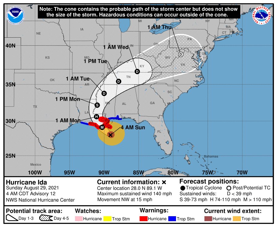
Hurricane Ida became a Category 4 storm early Sunday morning, rapidly intensifying to sustained winds of 145 mph, according to the National Hurricane Center (NHC). While the brunt of the storm and the most rain will be to the west of our area, Northwest Georgia could see 1-2 inches of rain from the storm.
The storm is located 65 miles south of the mouth of the Mississippi River, NHC forecasters said in a 6 am ET update, continuing its march northwest toward Louisiana and the Gulf Coast at 15 mph.
The hurricane has quickly increased in intensity since striking Cuba on Friday, threatening to be an “extremely dangerous major hurricane” when it makes its projected landfall along the Louisiana coast Sunday afternoon.
Ida gained 35 mph in sustained wind speed in just six hours, the NHC said.

“Ida is poised to strengthen further and based on recent satellite images it appears that strengthening is imminent,” the NHC said earlier. Outer bands from the storm are already making their way onshore across the Gulf Coast, impacting southeastern Louisiana, including New Orleans. A weather station at Southwest Pass reported sustained wind of 60 mph and a gust to 74 mph in the early morning hours.
A hurricane warning remains in effect from Intracoastal City, Louisiana, to the mouth of the Pearl River and includes Lake Pontchartrain, Lake Maurepas and New Orleans. There is also a danger of life-threatening storm surge inundation Sunday in areas along the coasts of Louisiana, Mississippi and Alabama.
Comments