




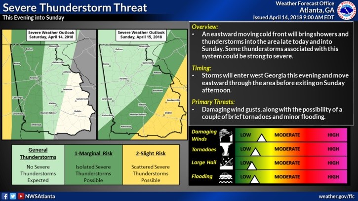
A strong storm system will track across Mississippi and Alabama through the day on Saturday, bringing widespread showers and thunderstorms ahead of it. Channel 12 Meteorologist Patrick Core says the heaviest storms will be this evening and tonight.
While the highest instability and severe threat will remain in Mississippi and Alabama on Saturday, the threat for some severe thunderstorms will increase in Northwest Georgia by late Saturday. Though some weakening is likely as the storms push eastward, a severe weather threat will persist Saturday night and into the day Sunday as this line moves east. Thunderstorms will end from west to east on Sunday as the cold front pushes eastward.
According to the National Weather Service, we should see cloudy skies today with high’s in the upper 70’s. By late evening we could see some of the heavier rain and thunderstorms moving into Chattooga County and Northwest Georgia. We could see 2-3 inches of rain from these storms, according to some forecast models.
Sunday there is a 100% chance for rain and thunderstorms with a high of 63. Sunday night the chance for rain drops to 30% with a low of 40 degrees.
To start the work week on Monday, we will see clearing conditions and cooler – highs Monday will only be around 56 degrees and lows on Monday night will drop into the upper 30’s.
Comments