






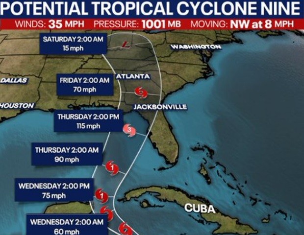
As Tropical Storm Helene churned its way across the warm waters of the Caribbean Sea on Tuesday, meteorologists closely monitored its rapid intensification. What had started as a disorganized area of low pressure just a day earlier had now officially blossomed into a full-fledged tropical storm, with maximum sustained winds of 50 mph. Impacts from the storm are expected to produce up to 7 inches of rain across Northwest Georgia and Northeast Alabama.
Forecasters predicted that Helene would continue to strengthen over the next 48 hours, potentially reaching major hurricane status – with winds exceeding 111 mph – before making landfall along Florida’s Big Bend region on Thursday afternoon. The storm’s large, sprawling circulation meant that impacts would be felt well outside the center, with heavy rainfall, powerful wind gusts, and the threat of isolated tornadoes expected to spread northward into parts of Georgia and Alabama later that same day and into Friday morning.
Residents in Chattooga County, northwest Georgia, and northeast Alabama are advised to closely monitor the storm’s progress and prepare for the possibility of power outages, downed trees, and flash flooding with the system later this week.
While its exact track and intensity remained somewhat uncertain, it is clear that this potent tropical system would bring a dangerous and disruptive dose of severe weather to the Southeast in the coming days.
Comments