










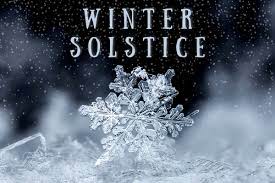
Winter officially arrives this afternoon at 4:48 Eastern Time, and by all accounts, it looks like we will certainly be feeling like winter as we head into Christmas weekend. The winter solstice marks the shortest day of the year in the Northern Hemisphere.
The word “solstice” derives from sol, the Latin word for sun, and sistere, which means “to come to a stop or make stand”. Arriving on the same day across the globe, a solstice occurs when the sun reaches its lowest or highest point in the sky during the year as a result of the Earth’s axis tilting to or away from the sun.
With winter arriving this evening, we will see rain and temperatures in the upper 30’s – not quite cold enough for winter precipitation, but in the extended forecast there is the possibility from some wintry mix on Thursday night into Friday morning when temperatures will fall into the teens. We could be waking up to single-digit temperatures on Christmas Eve morning.
The National Weather Service has issued a “Wind Chill Watch” for the weekend:
...WIND CHILL WATCH IN EFFECT FROM LATE THURSDAY NIGHT THROUGH
SATURDAY MORNING...

* WHAT...Dangerously cold wind chills possible. Wind chills as low
  as 10 below zero across most locales. Across the higher terrain,
  wind chills could reach as low as 15 to 20 below zero.

* WHERE...Portions of central, east central, north central,
  northeast, northwest, southeast and west central Georgia.

* WHEN...From late Thursday night through Saturday morning.

* IMPACTS...The cold wind chills could result in hypothermia if
  precautions are not taken.

* ADDITIONAL DETAILS....Temperatures are expected to rapidly begin
  dropping into the teens and 20s behind an arctic front late
  Thursday night into Friday. Lows on Saturday morning will range
  from the single digits to mid teens across much of north and
  central Georgia. In addition, windy conditions are anticipated
  with northwest winds of 15 to 20 mph with frequent gusts of 30
  to 40 mph likely. Higher gusts are possible in the higher
  terrain.
Comments