










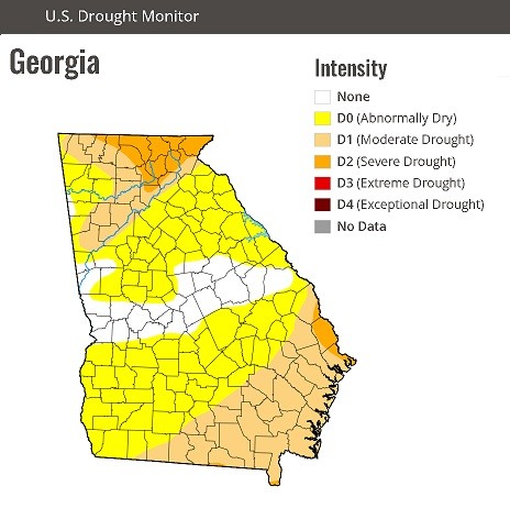
Recent rainfall has lowered the immediate wildfire threat across Northwest Georgia, but the latest U.S. Drought Monitor shows Chattooga, Floyd and Walker counties remain Abnormally Dry, indicating the region has not fully recovered from recent dry conditions.
The U.S. Drought Monitor map released July 2 classifies the three counties in the D0 – Abnormally Dry category. While D0 is not considered drought, it signals below-normal moisture levels and can serve as an early warning that drought could develop if hot, dry weather returns.
Georgia Forestry Commission officials say the recent rounds of rain have significantly reduced wildfire danger across much of the state after an active spring fire season. However, they caution that the improvement may be temporary. With summertime heat continuing, vegetation can dry quickly, increasing the potential for wildfires if rainfall becomes less frequent.
Scattered showers and thunderstorms are expected across Northwest Georgia throughout the week, which should help maintain soil moisture. Even so, officials encourage residents to continue using caution with outdoor burning and to remain aware of changing weather conditions.
Elsewhere in Georgia, portions of northeast and southeast Georgia continue to experience moderate drought, while areas of the state remain abnormally dry, according to the latest U.S. Drought Monitor.
Comments