


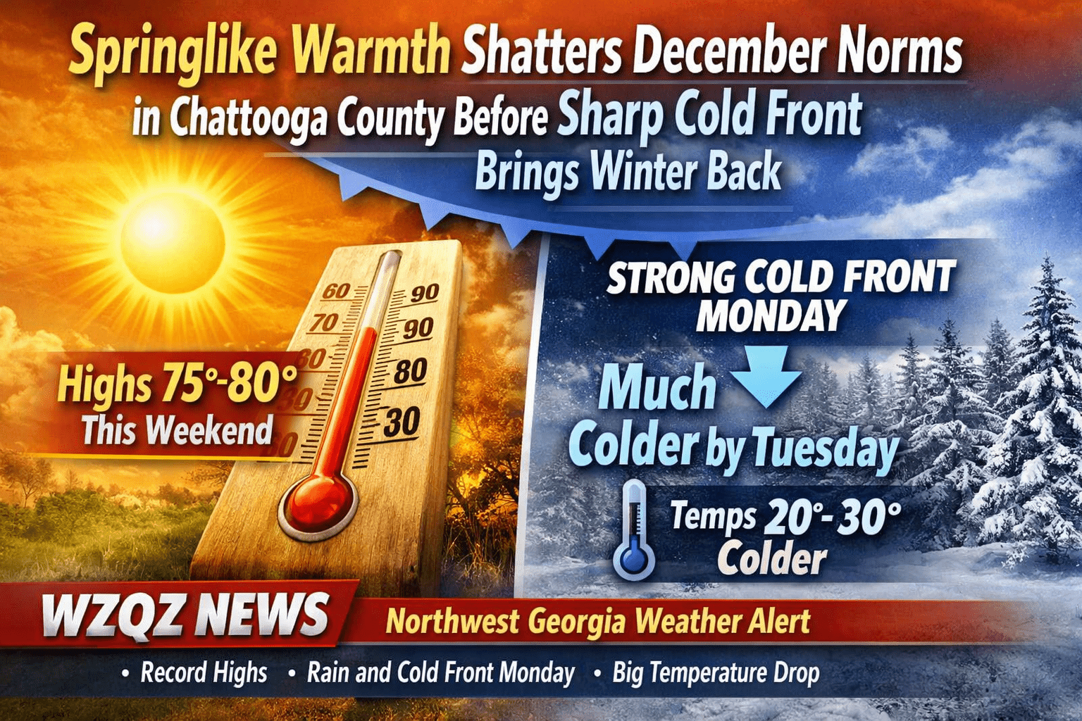
Unseasonably warm, spring-like weather is firmly in place across Chattooga County and Northwest Georgia, with temperatures running 15 to 25 degrees above normal through the weekend. Forecasters say today will likely be the warmest day, with highs soaring into the mid to upper 70s, and a few spots across the region flirting with 80 degrees—levels more typical of late spring than late December.
The unusual warmth has put daily temperature records at risk, not just locally but across much of north and central Georgia. Cloud cover this morning will give way to occasional sunshine this afternoon, allowing temperatures to climb rapidly.
Sunday will remain warm, though slightly less extreme for some areas. Highs are still expected to reach the 70s across much of Northwest Georgia, including Chattooga County. A few isolated light rain showers may develop, but rainfall amounts should be minimal and mostly limited to sprinkles or trace totals.
A strong cold front will sweep through the region early Monday, arriving first in Northwest Georgia. This front will bring a band of rain showers, but rainfall totals are expected to stay under a quarter inch. Thunder chances remain low.
Behind the front, temperatures will take a sharp turn. What begins as a warm Monday morning will transition into falling temperatures through the day. By Tuesday morning, lows will be 20 to 30 degrees colder compared to Monday morning, with many areas dipping below average for late December.
Cooler, more seasonable winter weather will dominate much of the upcoming week. High temperatures will range from the 30s and 40s in North Georgia to near 50 farther south, with cold air firmly in place across the region. While another weather system could approach next weekend, significant rain looks unlikely at this time—though another reinforcing shot of cold air is possible.
Comments