


![]()
A cold front moving through Georgia is bringing noticeably cooler and less humid conditions to Northwest Georgia today, ending the recent stretch of hot and stormy weather.

![]()
A cold front moving through Georgia is bringing noticeably cooler and less humid conditions to Northwest Georgia today, ending the recent stretch of hot and stormy weather.
![]()
Northwest Georgia will stay warm through the middle of next week, with afternoon highs expected to climb into the mid to upper 80s across much of the area.
![]()
Northwest Georgia residents can expect a few scattered showers and thunderstorms Monday before a stretch of cooler, drier weather settles into the region through midweek.

Residents in Chattooga and Floyd counties could see patchy fog this morning, with some areas experiencing dense fog through around 10 AM.

Northwest Georgia residents should prepare for several more rounds of showers and thunderstorms through Monday as an unsettled weather pattern lingers across the region. Forecast confidence remains low regarding exact timing and storm intensity, but forecasters say periods of rain and thunderstorms are expected through the weekend and into the start of the new week.
![]()
Rain will continue pushing out of Northwest Georgia this morning as a cold front moves away from the region. Behind it, high pressure will build in across Tennessee and North Georgia, bringing drier and cooler conditions through Friday.
![]()
Northwest Georgia will see a stretch of warm, quiet weather to start the week, but conditions are expected to change by midweek as a storm system moves into the region.
![]()
Residents across Chattooga County and Northwest Georgia are waking up to a noticeably cooler start to the week, with temperatures running 5 to 10 degrees below normal for early May.
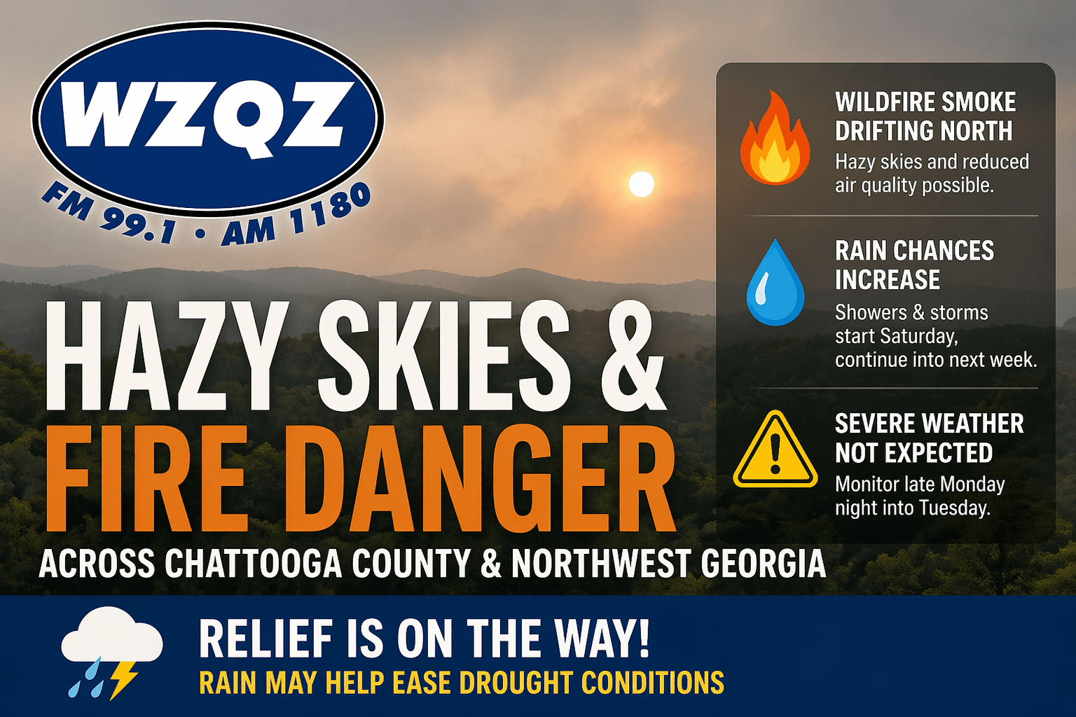
Chattooga County and much of Northwest Georgia will continue to deal with hazy skies today as wildfire smoke drifts north from South Georgia and North Florida. The smoke may create milky-looking skies and could lead to reduced air quality in some areas, especially where winds remain lighter.
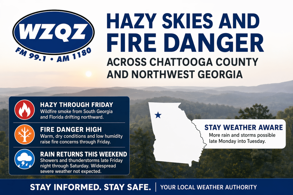
A stretch of hazy, dry, and unseasonably warm weather is gripping Chattooga County and much of Northwest Georgia, as wildfire smoke drifting north from South Georgia and Florida continues to impact air quality and visibility across the region.