










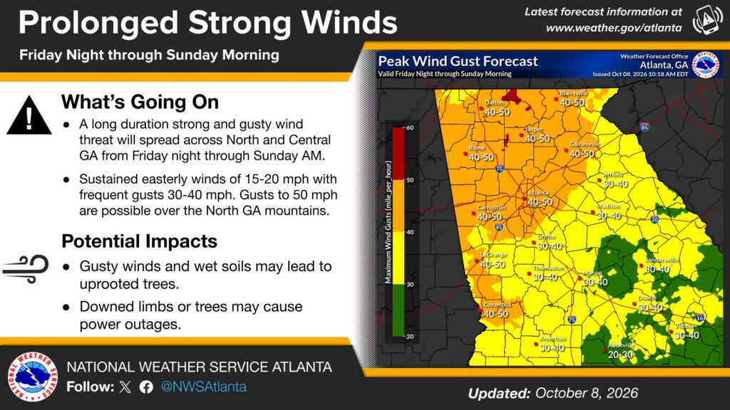
The National Weather Service in Peachtree City is warning residents across Chattooga County and Northwest Georgia to prepare for an extended period of strong, gusty winds beginning Friday night and continuing through Sunday morning.
In an updated forecast issued Thursday, October 8, meteorologists said a prolonged wind threat will affect much of North and Central Georgia as the approaching tropical weather system moves into the region.
Sustained easterly winds of 15 to 20 mph are expected, with frequent gusts reaching 30 to 40 mph. Stronger gusts approaching 50 mph are possible in the North Georgia mountains.
The National Weather Service forecast map places the Rome area and much of Northwest Georgia in a zone where peak wind gusts could reach 40 to 50 mph.
Forecasters are particularly concerned about the combination of strong winds and wet ground as heavy rainfall moves into the area.
Saturated soil can make trees more susceptible to being uprooted, even when wind speeds are below those normally associated with widespread damage.
Falling trees and broken limbs could damage homes, block roadways and knock down power lines, resulting in power outages.
Residents are encouraged to secure outdoor furniture, garbage cans, decorations and other loose items before winds increase Friday night.
Households should also charge cellphones and other electronic devices, have flashlights and batteries available, and prepare for possible interruptions in electrical service.
Drivers should use additional caution, particularly on roads surrounded by large trees and in areas exposed to strong crosswinds.
Residents should never approach downed power lines and should report them to their electric utility or emergency authorities.
The National Weather Service says the prolonged wind threat is expected to continue through Sunday morning, with conditions improving as the storm system moves away.
Comments