Storm Damage Reported Across Trion Monday Evening

Trion residents are cleaning up this morning following a strong thunderstorm that caused widespread damage across the town Monday evening.

Trion Police Chief David Gilleland told WZQZ News Monday night that the damage was extensive, with numerous trees and limbs brought down across town.

Damage was reported in front of Mount Vernon Mills and along Simmons Street, Town Hall Drive, Marsh Avenue and Pine Street, as well as several other locations. Crews had already cleared the area in front of the mill when Gilleland spoke with WZQZ shortly before 7:45 PM.

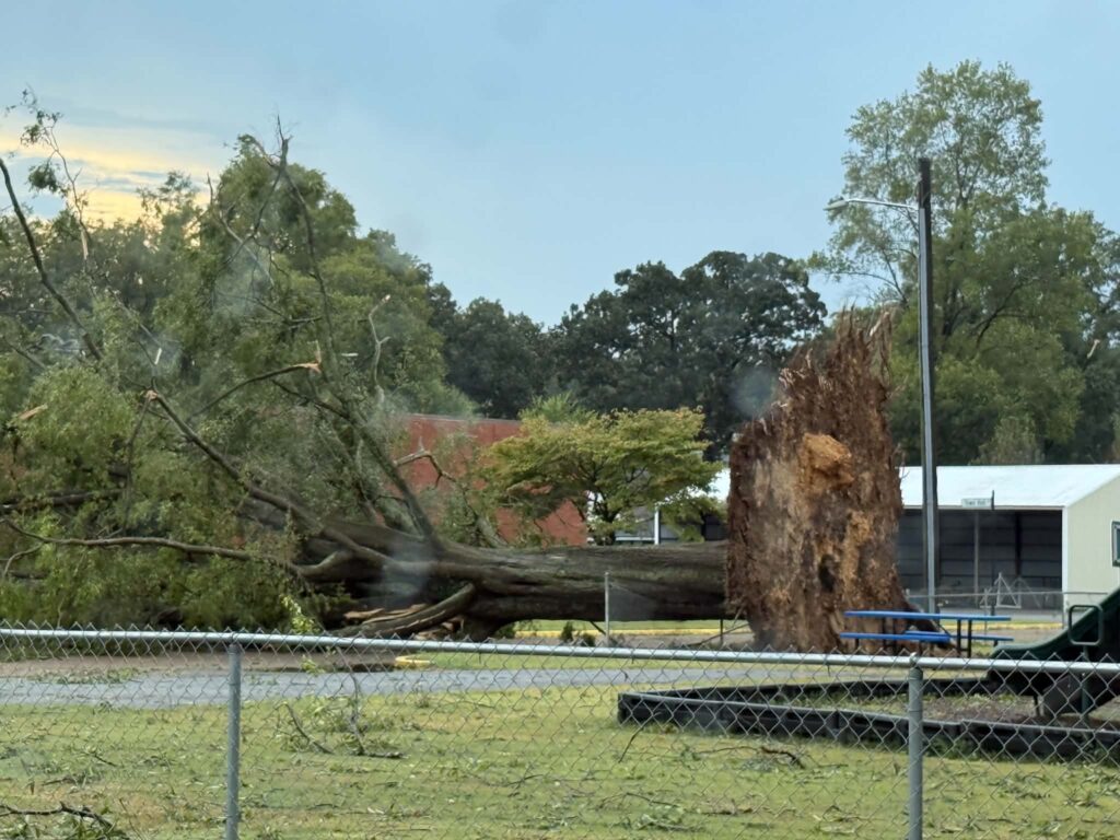
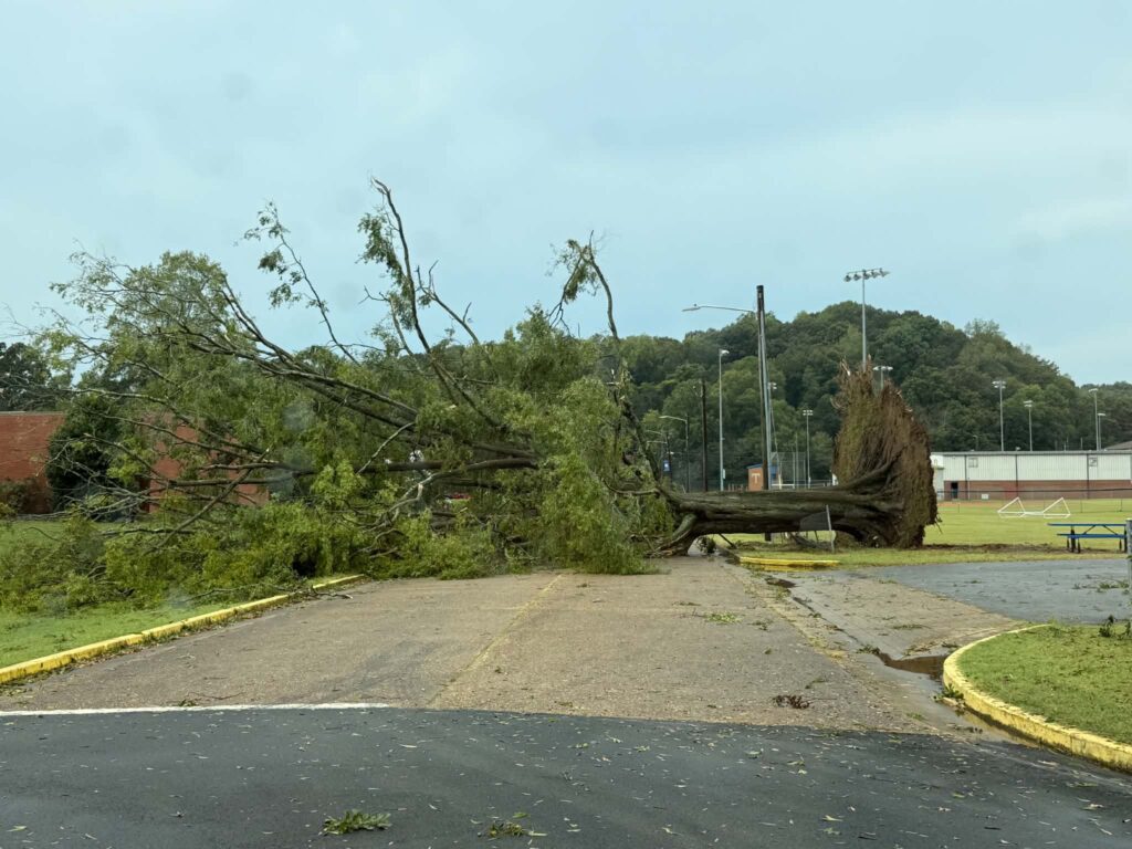
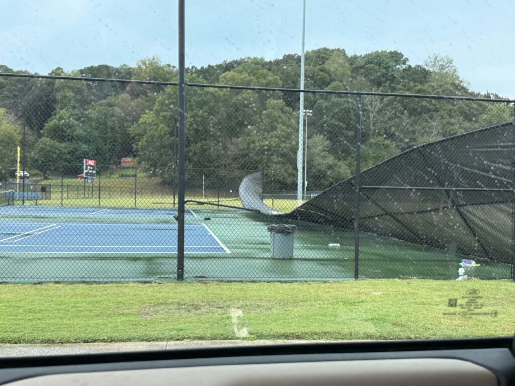
One of the more significant areas of damage was at the Trion Recreation Department, where a large tree came down near the tennis courts.

Gilleland told WZQZ the falling tree took out the entire fence surrounding the tennis courts.

Some residents along side streets also experienced power outages Monday evening, although power remained on at Trion School following the storm.

Most importantly, Gilleland said no injuries had been reported as of Monday night.

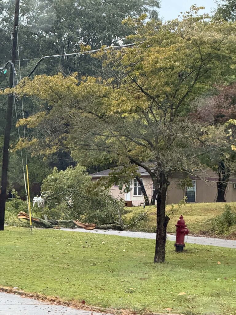
Photos taken around Trion following the storm showed large trees and limbs down near homes and along roadways.

There was no immediate confirmation that a tornado was responsible for the damage. The storms that moved through the area were capable of producing strong, damaging wind gusts.

Crews were working Monday evening to clear trees and debris and assess the extent of the damage.
Wind Advisory Today as Colder Air Moves Into Northwest Georgia

Breezy northwest winds and a sharp drop in temperatures are impacting Chattooga County and much of Northwest Georgia today, with colder air expected to linger through Monday.

The National Weather Service has issued a Wind Advisory from 8 a.m. to 7 p.m. EST Sunday as a tight pressure gradient between a developing Nor’easter and high pressure over the Plains drives strong northwest winds across Georgia.

Read more

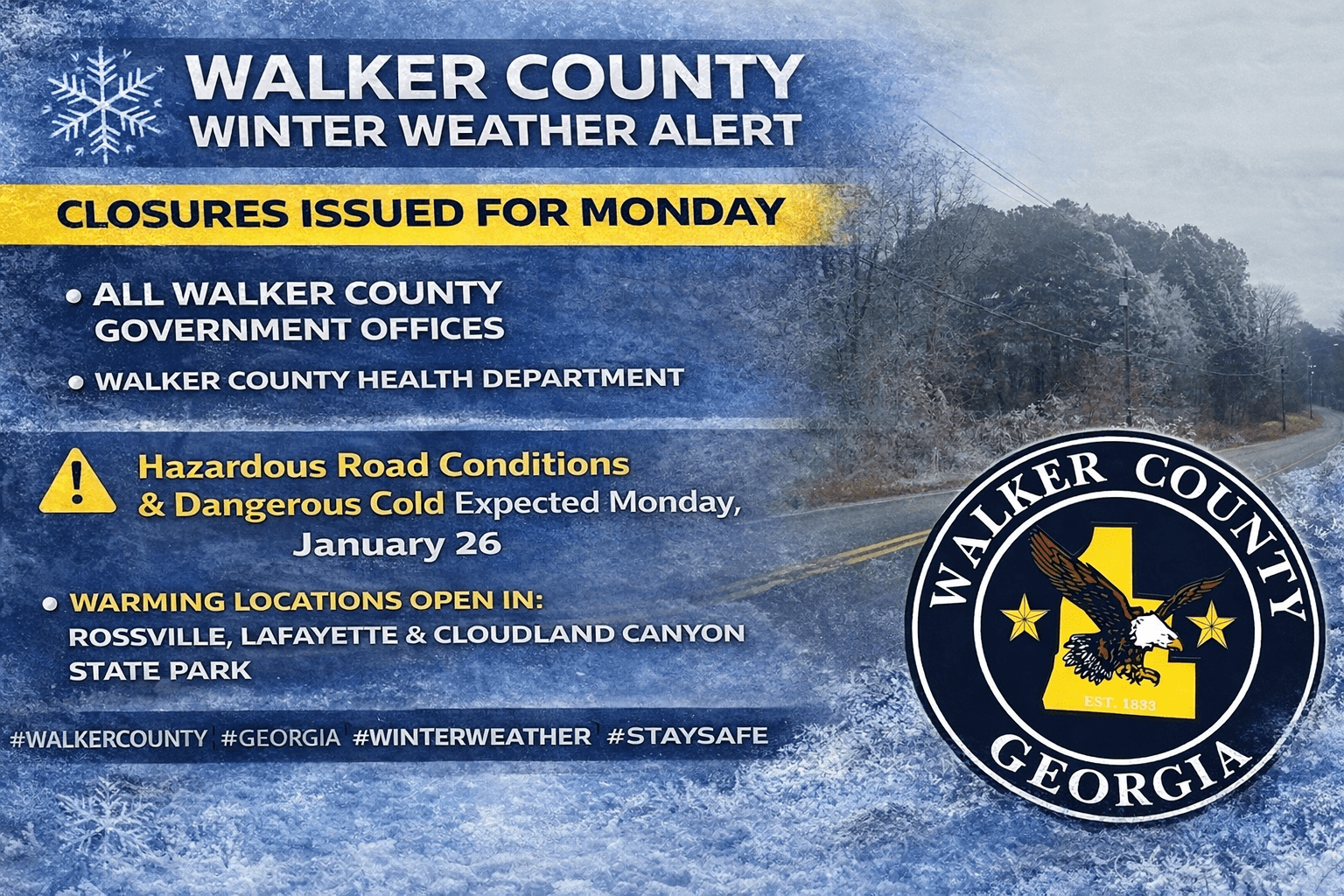
Walker County Sees Winter Weather Impacts; Closures Issued for Monday

While most of Chattooga County avoided widespread icy conditions on Sunday—aside from some winter precipitation reported on Lookout Mountain—parts of Walker County were hit harder by the winter weather. Officials reported around 200 households without power on Sunday as the system moved through the area.

In response, several warming options were made available. Warming stations opened in Rossville and LaFayette, and Georgia State Parks opened a warming shelter at Cloudland Canyon State Park on Lookout Mountain to help residents needing a warm place during the cold snap.

Because of the continued threat of hazardous travel and dangerously cold temperatures, Walker County Government offices will be closed Monday, January 26. The closure includes county offices as well as the landfill and transit services.

In addition, the Walker County Health Department will also be closed Monday, January 26.

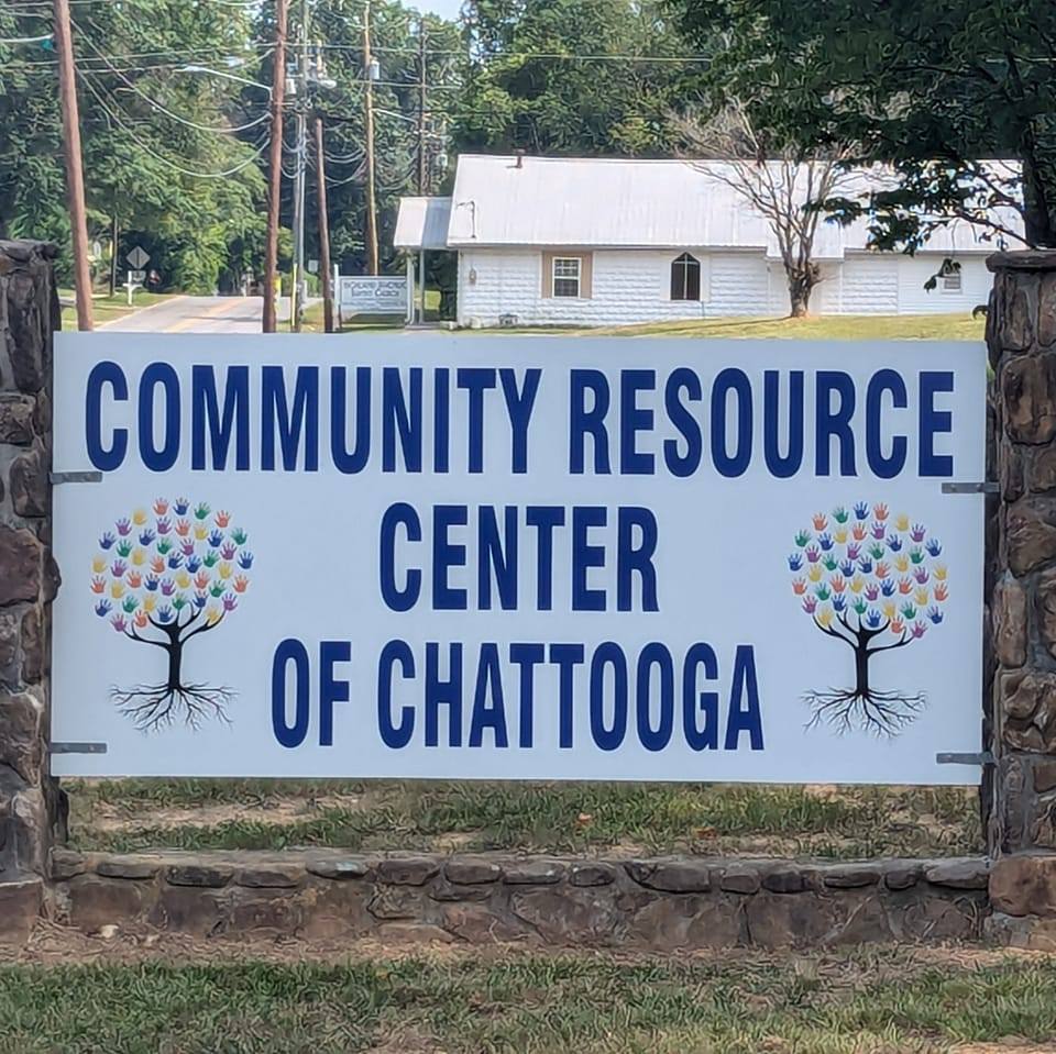
Chattooga Community Resource Center Closing Monday; Warming Shelter Open at North Summerville Gym

The Chattooga Community Resource Center (CRC) announced it will be closed Monday, January 26, 2026, due to predicted inclement weather, saying the decision is aimed at keeping volunteers and the community safe. CRC is urging residents to avoid travel unless it’s an emergency, especially as winter weather impacts are expected across the area.

CRC also reminded residents that anyone who loses power and needs a warm place to stay should go to the gym at the old North Summerville School, located behind the Community Resource Center. The gym will be open to all residents as a warming location. If someone cannot make it to the gym, CRC says to call 9-1-1, and transportation can be arranged.

The message from CRC is simple: don’t stay home without heat, food, or help—use the resources available. CRC ended its announcement with a reminder of community strength: “We are in this together. We are Chattooga Strong.”

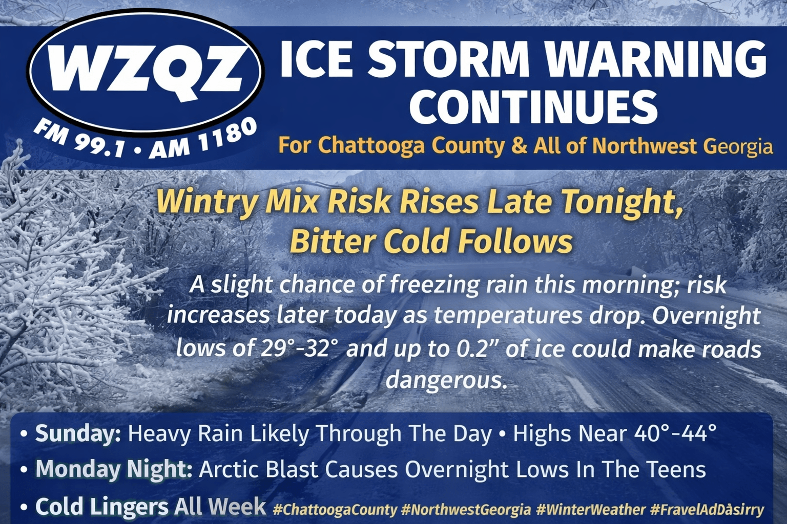
Ice Storm Warning Continues for Chattooga County and Northwest Georgia; Wintry Mix Risk Rises Tonight, Bitter Cold Follows

While Chattooga County and all of Northwest Georgia remain under an Ice Storm Warning, the National Weather Service forecast for our area is calling for only a slight chance of freezing rain before 10 AM this morning. Early temperatures were running marginal for widespread icing, with LaFayette and Mentone hovering just below freezing at 31 degrees, while Gaylesville, Alabama and Rome were closer to 40. Summerville was sitting at 35 degrees. Those readings are a bit warm for freezing rain in many spots, but sleet could still fall anywhere across the area, especially in heavier bursts of precipitation.

Read more

Chattooga County Agencies Urge Residents to Prepare for Icing, Possible Outages and Hazardous Roads

As a winter storm moves into Northwest Georgia, emergency management and local agencies across Chattooga County are urging residents to stay informed, prepare now, and avoid travel if icing develops.

Read more

Georgia Power and North Georgia EMC Suspend Service Disconnections Ahead of Winter Storm

As a severe winter storm threatens parts of Georgia with the potential for destructive ice and snow, both Georgia Power and North Georgia EMC (NGEMC) have announced temporary suspensions of service disconnections to help keep customers safe during the event.

Read more

Ice Storm Warning Issued for Chattooga County; Significant Icing Expected Across Northwest Georgia

A high-impact winter storm is expected to bring significant icing to Chattooga County and parts of Northwest Georgia this weekend, prompting the National Weather Service to issue an Ice Storm Warning. The warning is in effect from 7:00 AM Saturday until 10:00 AM Monday.

Read more

Winter Storm Watch Expanded Across North Georgia as Ice, Power Outages, and Dangerous Cold Threaten Weekend

Forecasters say a high-impact winter storm is increasingly likely across Georgia this weekend, with freezing rain and ice expected to be the primary hazards and the potential for widespread power outages and dangerous travel conditions. The Winter Storm Watch has been expanded to include most of North Georgia and a small portion of Central Georgia, with the watch starting 1:00 AM Saturday for the far northern tier and beginning 1:00 PM Saturday for areas generally near and south of I-20. Both time periods extend through 10:00 AM Monday.

Read more

Winter Weather Watch Issued as High-Impact Ice Storm Threatens Northwest Georgia This Weekend

A high-impact winter storm is expected to move into northern Georgia this weekend, and forecasters say the biggest concerns for Northwest Georgia are ice, dangerous travel, and possible power outages. A Winter Weather Watch begins at 1:00 a.m. Saturday and continues into Monday morning as multiple storm systems interact with a surge of Arctic air pushing south.

Read more