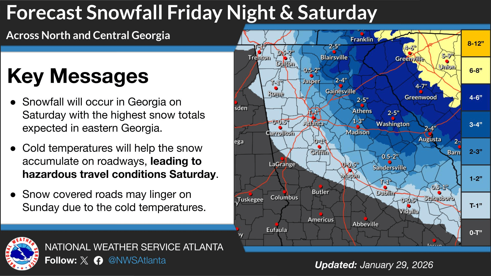
A winter storm moving across parts of Tennessee, Georgia, and the Carolinas will be the main weather story over the next 24 to 48 hours, with widespread snowfall expected across portions of the region. Forecasters say confidence is high in the overall setup: an unusually strong upper-level low dropping out of Canada will drive a surge of Arctic air into the Southeast, while a surface low strengthens rapidly off the Georgia and South Carolina coast. As that coastal system intensifies, moisture will wrap back into Georgia, combining with lift from the upper-level low to produce snow—though where the western edge of the snow sets up remains one of the biggest uncertainties.