


![]()
Daily chances for showers and thunderstorms are expected across north and central Georgia over the next seven days, but forecasters say the rain is not expected to bring much meaningful improvement to ongoing drought conditions.

![]()
Daily chances for showers and thunderstorms are expected across north and central Georgia over the next seven days, but forecasters say the rain is not expected to bring much meaningful improvement to ongoing drought conditions.
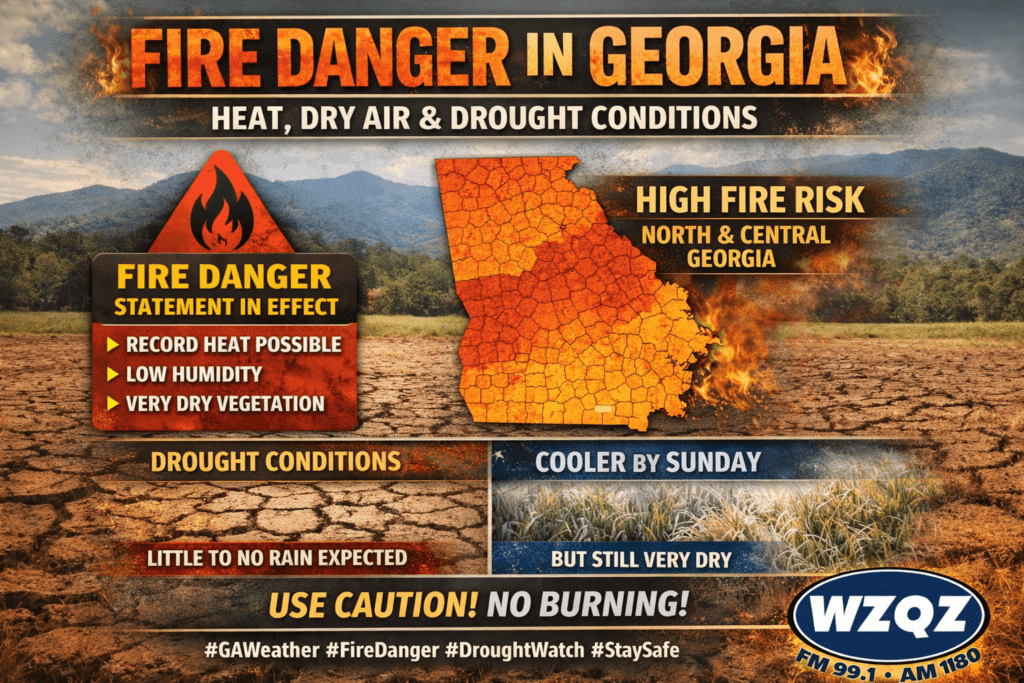
A Fire Danger Statement remains in effect across portions of north and central Georgia as dry vegetation, low humidity, and unusually warm temperatures continue to create dangerous fire weather conditions through the end of the week.

A Fire Danger Statement remains in effect for all of north and central Georgia, including Chattooga County and surrounding Northwest Georgia communities, until 6PM today due to low relative humidity levels and dry conditions.
Snow is expected to remain to the east and south of Chattooga County, while local residents see a colder, quieter stretch of weather through early next week. Cloudy skies will hang on through midmorning today before gradual clearing takes over, with temperatures topping out near 41 degrees. A west wind of 5 to 10 mph will add a bite at times, with gusts that could reach 20 mph.
A cold front is pushing into Northwest Georgia this morning, bringing periods of light, hit-or-miss showers as it advances south and east. In Chattooga County, the pattern favors scattered rain that becomes more broken and less organized through the day, with rainfall amounts generally staying on the lighter side. Temperatures will remain chilly but typical for mid-January, with afternoon readings mainly in the 50s across much of Northwest Georgia outside of the higher terrain.