


Residents across Chattooga County and Northwest Georgia are facing a double dose of winter weather as a Wind Advisory remains in effect until 7 p.m. Sunday, followed by a Cold Weather Advisory from 1 a.m. to 10 a.m. Monday.

Residents across Chattooga County and Northwest Georgia are facing a double dose of winter weather as a Wind Advisory remains in effect until 7 p.m. Sunday, followed by a Cold Weather Advisory from 1 a.m. to 10 a.m. Monday.

Once again, Georgia and much of the Deep South appear headed for a round of winter weather this weekend, but like last weekend, the best chance for frozen precipitation looks to stay mainly east of Chattooga, Floyd, and Walker Counties. The National Weather Service says confidence continues to increase for measurable snowfall across parts of northeast and east-central Georgia between Friday night and Saturday night, prompting a Winter Storm Watch for those areas.
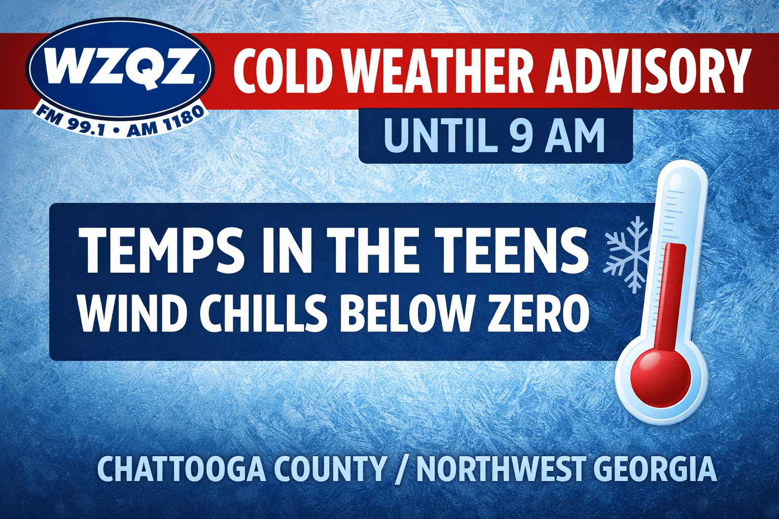
A Cold Weather Advisory remains in effect this morning until 9 AM as temperatures in the teens are being reported across Chattooga County and the greater Northwest Georgia area. Very cold wind chills ranging from 5 below to 5 above zero are being observed, creating dangerous conditions for anyone exposed for extended periods of time.
![]()
A blast of winter air is settling over Chattooga County and the rest of Northwest Georgia Monday, and the National Weather Service in Peachtree City is warning that some roads could turn slick in spots during the morning hours.
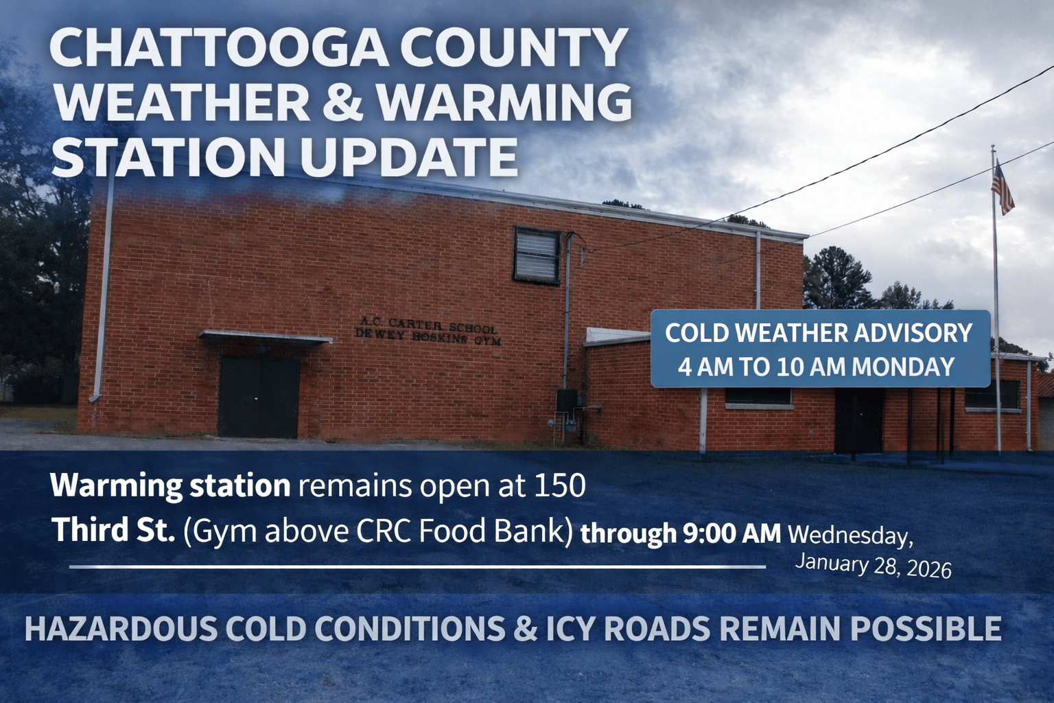
As frigid air settles into Chattooga County behind the weekend rain, volunteers with the Chattooga County Community Resource Center will continue operating a warming station at 150 Third Street in Summerville, located in the gym above the CRC Food Bank.
The warming station will remain available through Wednesday morning, January 28, 2026, and is scheduled to close at 9:00 a.m. that day.
The warming station hours are 5:00 p.m. to 9:00 a.m. Monday and Tuesday. If power outages occur, the site will transition to continuous operation to provide a safe, warm place for those who need it.
Chattooga County Public Works, city maintenance departments, and local law enforcement will continue monitoring road conditions and treating roadways as needed.
Residents are urged to stay weather-aware as dangerously cold conditions will be with us for the next couple of days.
Drivers should use caution if traveling, particularly this evening and overnight as temperatures drop.

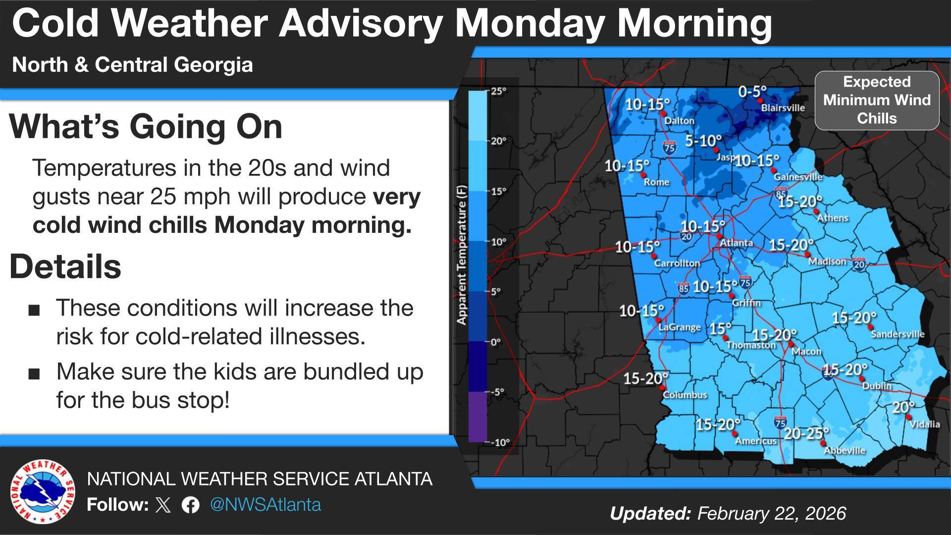
A Cold Weather Advisory remains in effect across Chattooga County and Northwest Georgia this Monday morning as a blast of Arctic air sends temperatures plunging into the teens, with wind chill values in the single digits in some locations. The coldest readings are expected in low-lying and rural areas, where residents may feel the harshest impacts during the early morning hours.
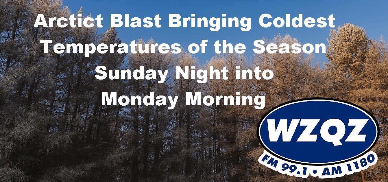
An arctic cold front moving into northwest Georgia tonight will bring gusty winds and the coldest air of the season to Chattooga County Sunday night into Monday morning. A Cold Weather Advisory is in effect Sunday evening through Monday morning, and residents are urged to prepare now for a sharp drop in temperatures.