


![]()
Thursday will bring mostly sunny skies to Chattooga County and Northwest Georgia, with afternoon temperatures climbing to near 88 degrees. Winds will remain light, becoming south around 5 mph during the day.

![]()
Thursday will bring mostly sunny skies to Chattooga County and Northwest Georgia, with afternoon temperatures climbing to near 88 degrees. Winds will remain light, becoming south around 5 mph during the day.
![]()
A stretch of pleasant summer weather will continue across Chattooga County through the remainder of the week before temperatures begin climbing into the 90s this weekend and early next week.
![]()
A cold front moving through Georgia is bringing noticeably cooler and less humid conditions to Northwest Georgia today, ending the recent stretch of hot and stormy weather.
After a stretch of dry weather, showers and thunderstorms are making a return to Chattooga County and Northwest Georgia today as a more active weather pattern settles across the region.
The stretch of dry weather that has dominated Northwest Georgia during recent days is nearing its end as moisture begins flowing back into the region and afternoon thunderstorm chances make a comeback.

Residents in Chattooga and Floyd counties could see patchy fog this morning, with some areas experiencing dense fog through around 10 AM.
Residents across Chattooga County and Northwest Georgia can expect a return to wet weather as multiple rounds of showers move through the area today and into Saturday.
![]()
Residents across Chattooga County and Northwest Georgia are waking up to rounds of showers and a few embedded thunderstorms early Thursday, but conditions are expected to steadily improve as the day goes on.
Northwest Georgia, including Chattooga County, is expected to see several days of unsettled weather as showers and thunderstorms move through the region over the coming week.
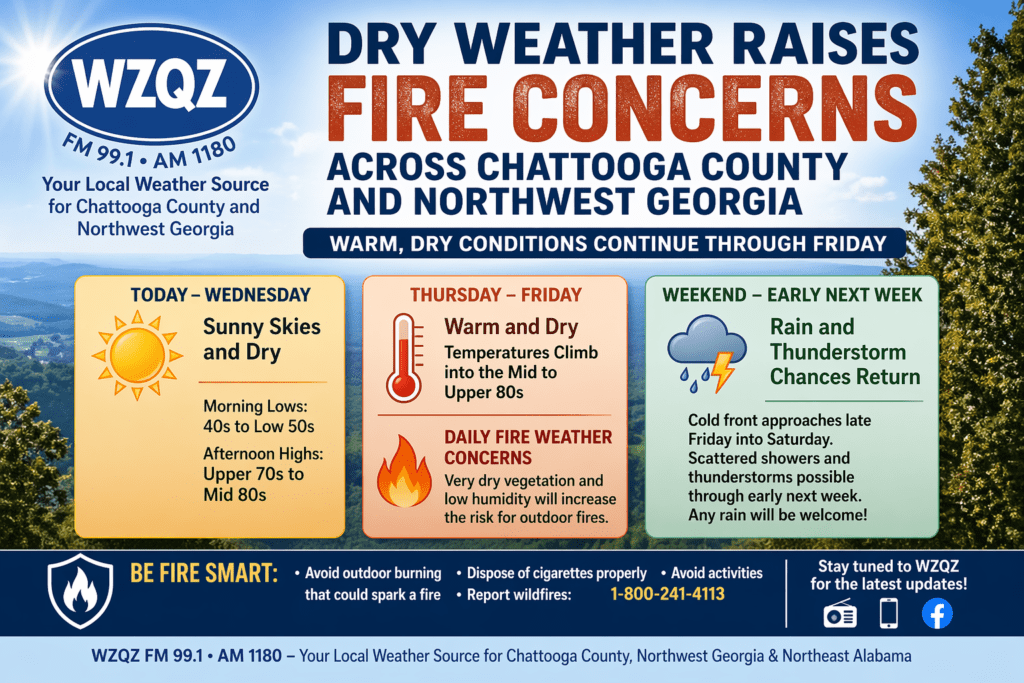
Residents across Chattooga County and the wider Northwest Georgia region can expect several more days of warm, dry weather, increasing the risk for outdoor fires through the end of the workweek.