


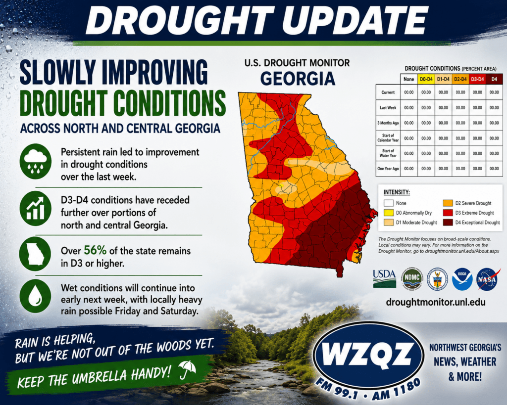
Weeks of steady rainfall are beginning to make a noticeable difference across Northwest Georgia, with drought conditions continuing to improve throughout the region.

Weeks of steady rainfall are beginning to make a noticeable difference across Northwest Georgia, with drought conditions continuing to improve throughout the region.

Northwest Georgia will remain stuck in an unsettled weather pattern through the beginning of next week, with scattered to numerous showers and thunderstorms expected across the area.
![]()
A brief break in the more widespread wet weather pattern is expected across Chattooga County and Northwest Georgia today, but forecasters say the break will likely be short-lived.
![]()
Northwest Georgia will get a little break from the heavier coverage of showers and storms today and Thursday, but the rainy pattern is far from over.

Residents across Chattooga County and Northwest Georgia should prepare for several more days of wet and stormy weather as an active weather pattern continues to bring repeated rounds of showers and thunderstorms across the region.
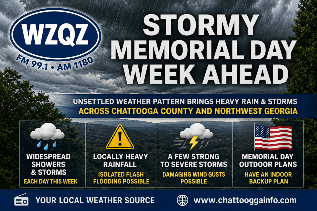
Residents across Chattooga County and Northwest Georgia should prepare for several days of unsettled weather as a persistent summer-like pattern brings widespread showers and thunderstorms through much of the upcoming week.
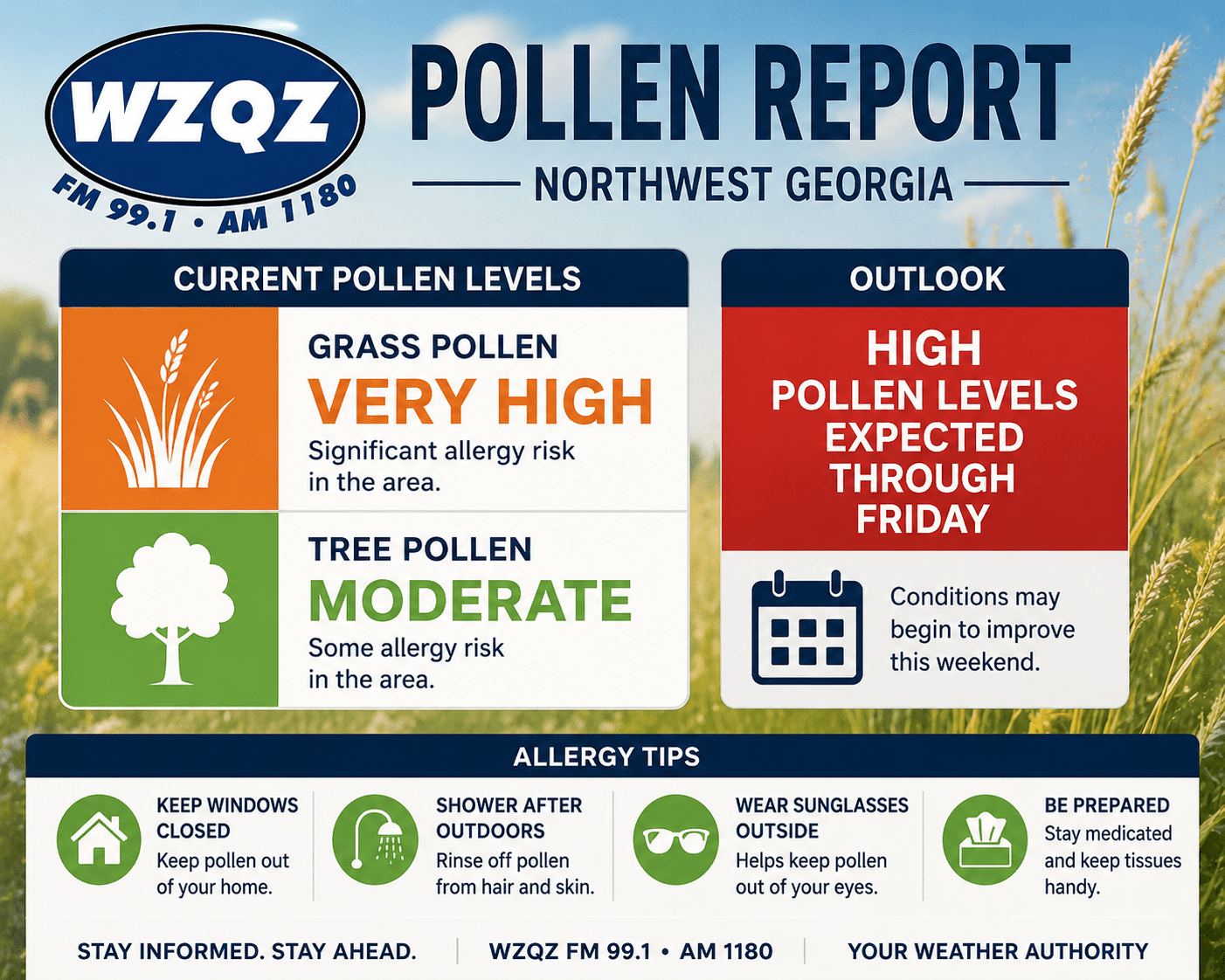
Allergy sufferers across Northwest Georgia are dealing with very high grass pollen levels today, creating a significant allergy risk throughout the area. Forecasters say the elevated pollen counts are expected to remain high through Friday.
Tree pollen levels are currently listed as moderate, but the high concentration of grass pollen is likely to trigger symptoms for many residents, including sneezing, itchy eyes, congestion, and headaches.
Recent warm temperatures combined with spring growth have helped fuel the increase in pollen across the region. Dry conditions and breezy weather can also allow pollen to spread more easily through the air.
Health experts recommend limiting outdoor activity during peak afternoon hours, keeping windows closed, showering after spending time outside, and taking allergy medications as directed.
Conditions could begin to improve later this weekend as increased rain chances move back into Northwest Georgia.
![]()
Rain will continue pushing out of Northwest Georgia this morning as a cold front moves away from the region. Behind it, high pressure will build in across Tennessee and North Georgia, bringing drier and cooler conditions through Friday.
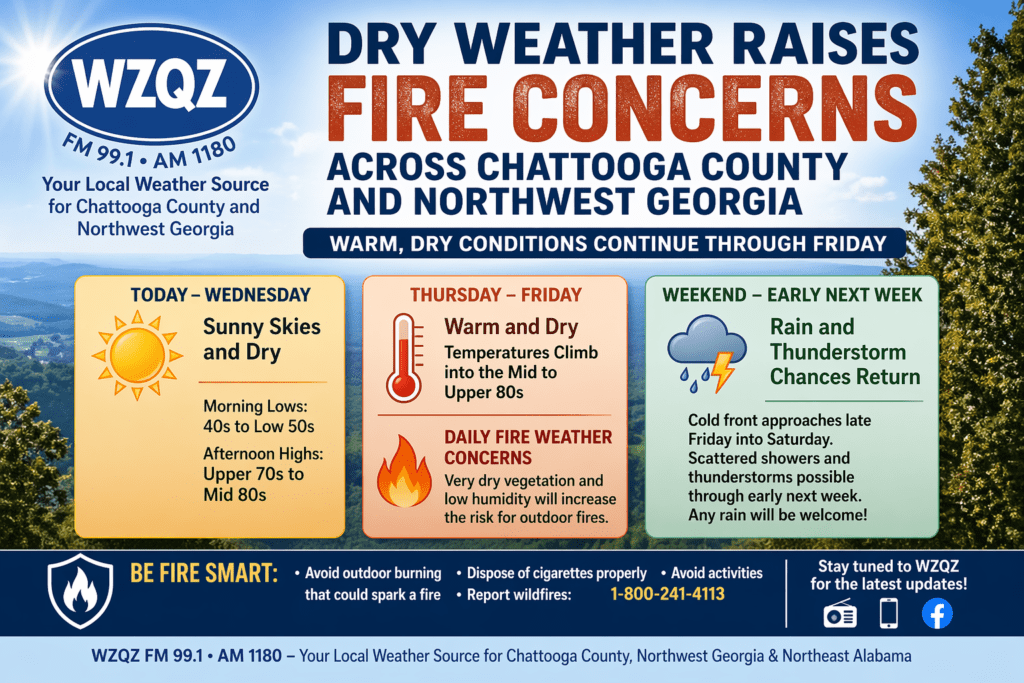
Residents across Chattooga County and the wider Northwest Georgia region can expect several more days of warm, dry weather, increasing the risk for outdoor fires through the end of the workweek.
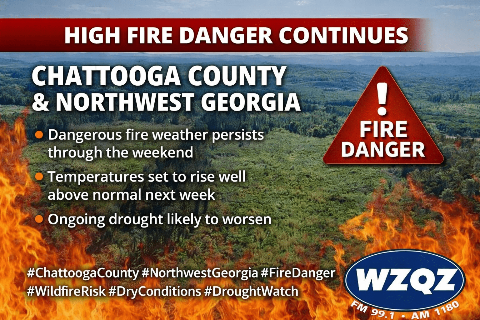
Residents across Chattooga County and the broader Northwest Georgia region should remain on alert as high fire danger conditions persist through the weekend. Dry weather, low humidity, and warming temperatures are creating an elevated risk for wildfire activity.