


![]()
Rain will continue pushing out of Northwest Georgia this morning as a cold front moves away from the region. Behind it, high pressure will build in across Tennessee and North Georgia, bringing drier and cooler conditions through Friday.

![]()
Rain will continue pushing out of Northwest Georgia this morning as a cold front moves away from the region. Behind it, high pressure will build in across Tennessee and North Georgia, bringing drier and cooler conditions through Friday.
![]()
Residents across Chattooga County and Northwest Georgia are waking up to rounds of showers and a few embedded thunderstorms early Thursday, but conditions are expected to steadily improve as the day goes on.
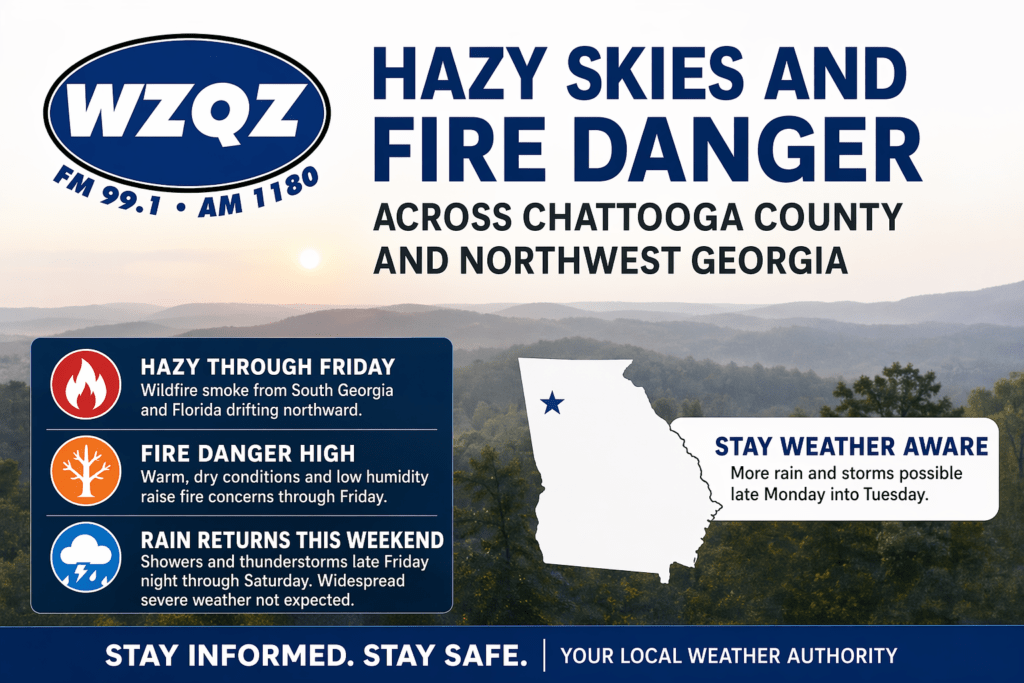
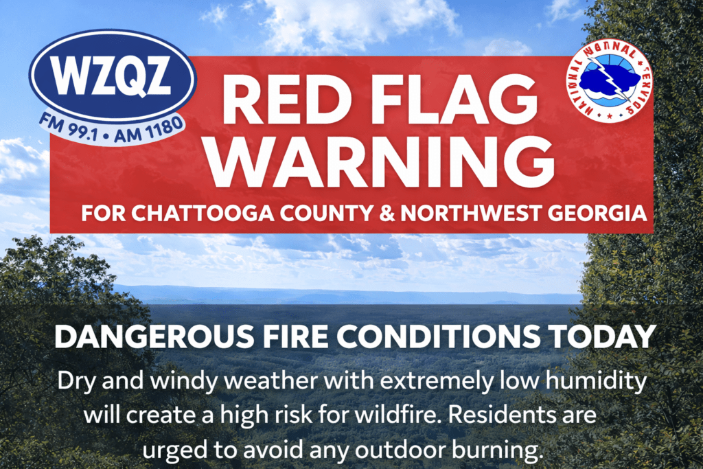
A stretch of hazy, dry, and unseasonably warm weather is gripping Chattooga County and much of Northwest Georgia, as wildfire smoke drifting north from South Georgia and Florida continues to impact air quality and visibility across the region.
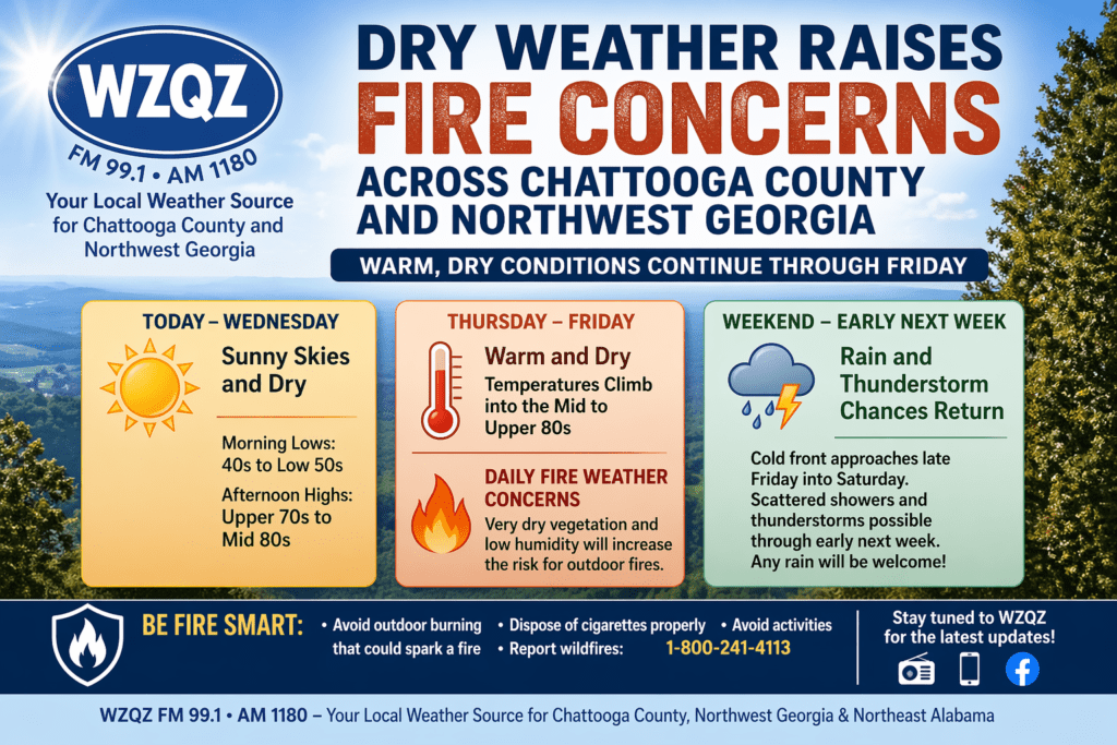
Residents across Chattooga County and the wider Northwest Georgia region can expect several more days of warm, dry weather, increasing the risk for outdoor fires through the end of the workweek.
A cold front moved into Northwest Georgia early Sunday, bringing only limited rainfall to Chattooga County and surrounding areas. While a few scattered showers passed through during the morning hours, most communities across the region are expected to receive very little rain, with many spots seeing less than a tenth of an inch. Even in the areas that pick up the most rainfall, totals are not expected to be enough to make a meaningful dent in the ongoing dry conditions.
![]()
Residents across Chattooga County and Northwest Georgia are waking up to patchy dense fog this morning, with visibility in some areas dropping to as low as half a mile. The fog is expected to linger through about 10 AM, especially in spots that saw rainfall yesterday, before gradually clearing.

Chattooga County and Northwest Georgia are in for a cloudy and cooler stretch today and tonight (Tuesday, March 3, 2026) as a cool-air damming (CAD) wedge strengthens across the eastern side of the state. That setup is being driven by high pressure positioned off the Upper East Coast, funneling cool, moist easterly winds down the eastern seaboard and into Georgia. The result locally will be a gray, low-cloud kind of day, with low ceilings pressing into the region and holding temperatures down compared to what you’d normally expect this time of year.

A Dense Fog Advisory is in effect for Chattooga County and much of Northwest Georgia through 10 a.m., with some areas possibly seeing reduced visibility until 11 a.m. Officials warn that visibilities could drop to one-quarter mile or less, creating hazardous travel conditions during the morning commute.
After a mostly quiet start to Friday in Chattooga County, residents should be ready for wet roads and off-and-on showers as rain builds back into Northwest Georgia late today and lasts into Saturday. Forecasters expect clouds to thicken through the afternoon as moisture streams north, setting the stage for showers to spread in late Friday evening and overnight.
![]()
Chattooga County and the rest of Northwest Georgia are in for an unusually warm stretch through Christmas and into the weekend, with afternoon temperatures running well above normal and flirting with record to near-record levels.