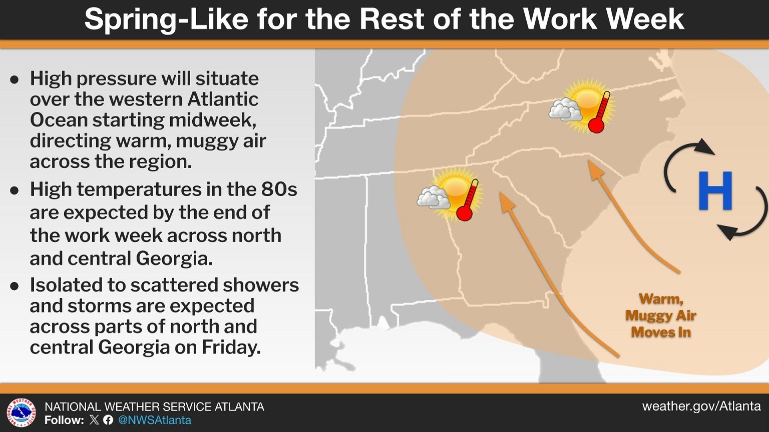
Residents across Chattooga County and Northwest Georgia are waking up to cloudy skies and areas of patchy fog this morning as warm, moist air moves into the region. Forecasters say a weakening wedge of high pressure has shifted toward the Atlantic, forming more of a Bermuda high pattern. This setup is allowing southeasterly winds to bring warmer and more humid air into the area, gradually pushing temperatures well above normal for early March.
Residents across Chattooga County and Northwest Georgia will notice a cooler and cloudier start to the week as a Cold Air Damming (CAD) wedge builds down the East Coast and settles into Northeast Georgia.
Forecasters say mostly clear skies early Monday will quickly give way to increasing cloud cover, especially across Northeast Georgia. The strengthening wedge will push cooler air into the region, holding afternoon highs in the mid-50s in parts of Northeast Georgia. In contrast, areas farther south in Georgia could still see temperatures climb into the mid-70s.
Chattooga County and the rest of Northwest Georgia are waking up to patchy fog this Sunday morning, but clearer skies are quickly taking over as high pressure settles across the region. The National Weather Service in Peachtree City, Georgia says mostly clear conditions will dominate today after the fog dissipates shortly after sunrise. Dry weather is expected to continue through Monday as a strong surface high builds down the Eastern Seaboard.


