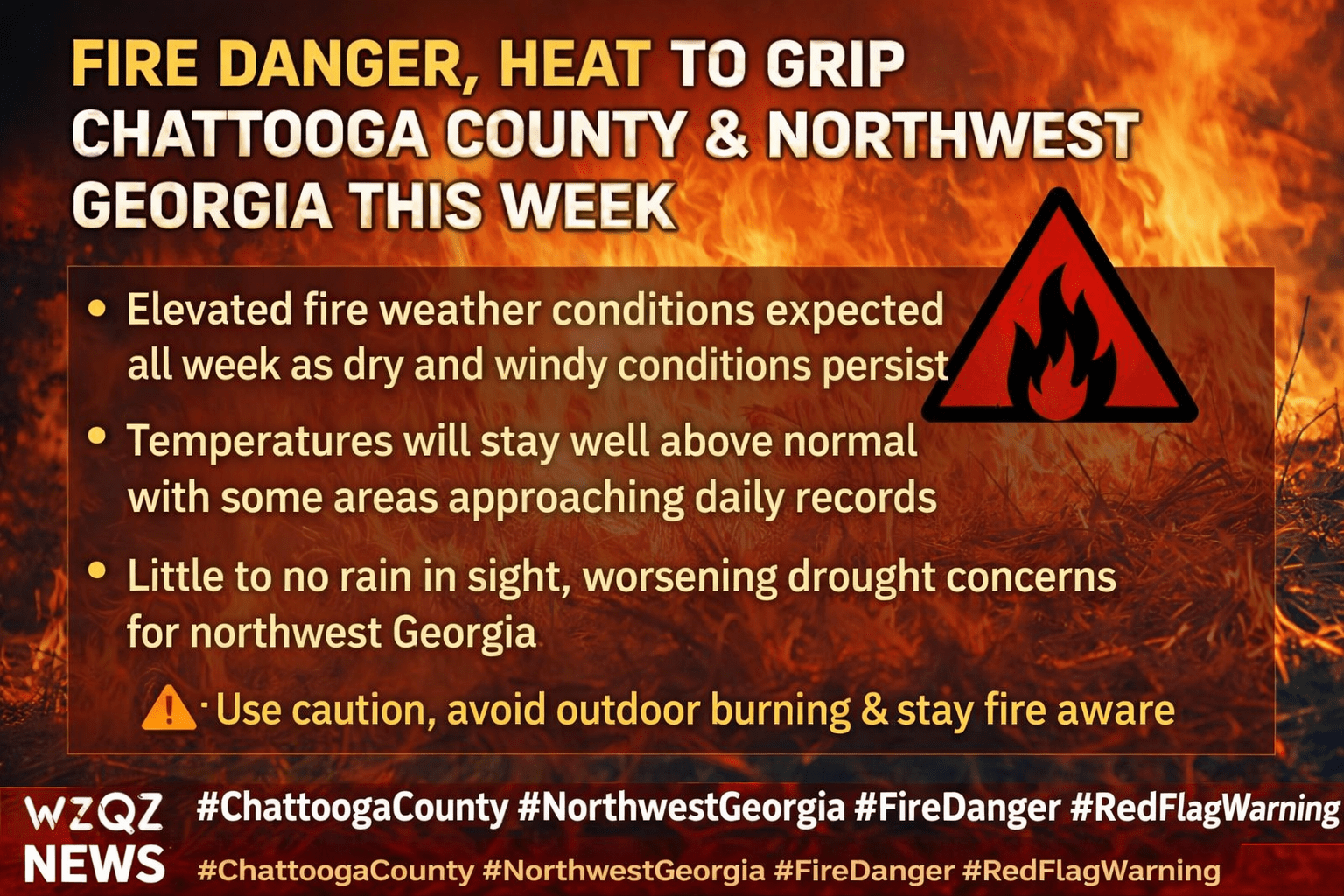
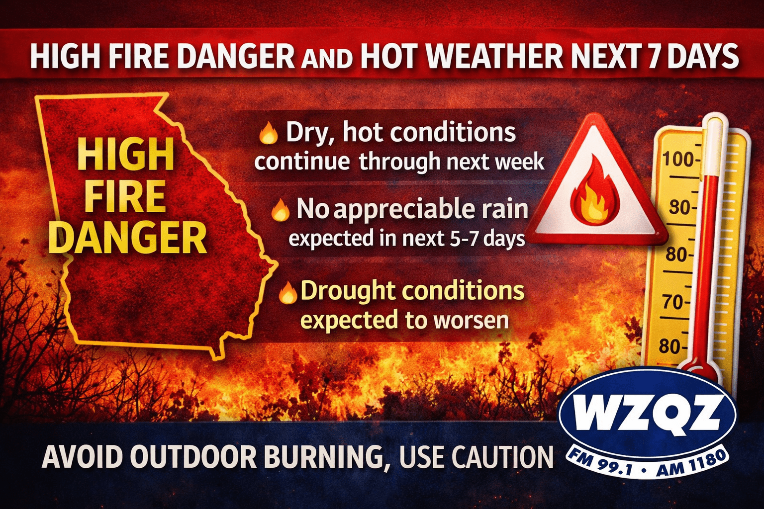
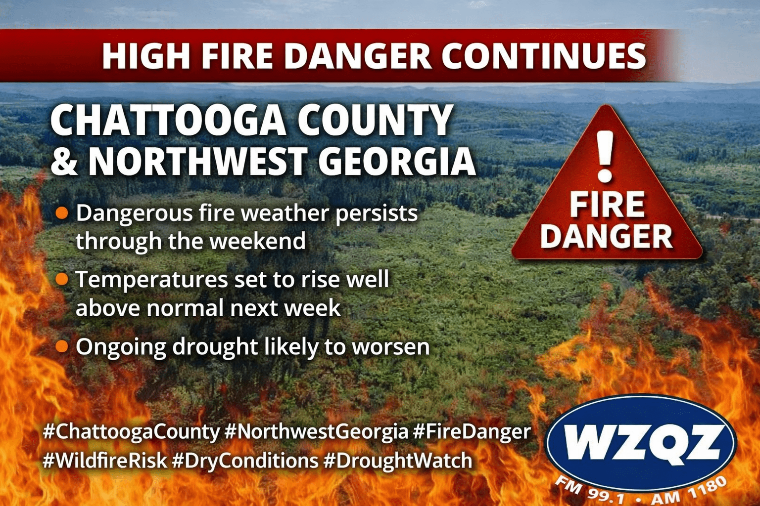
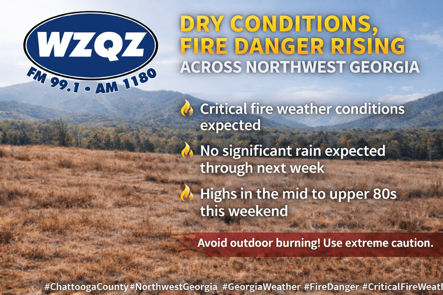
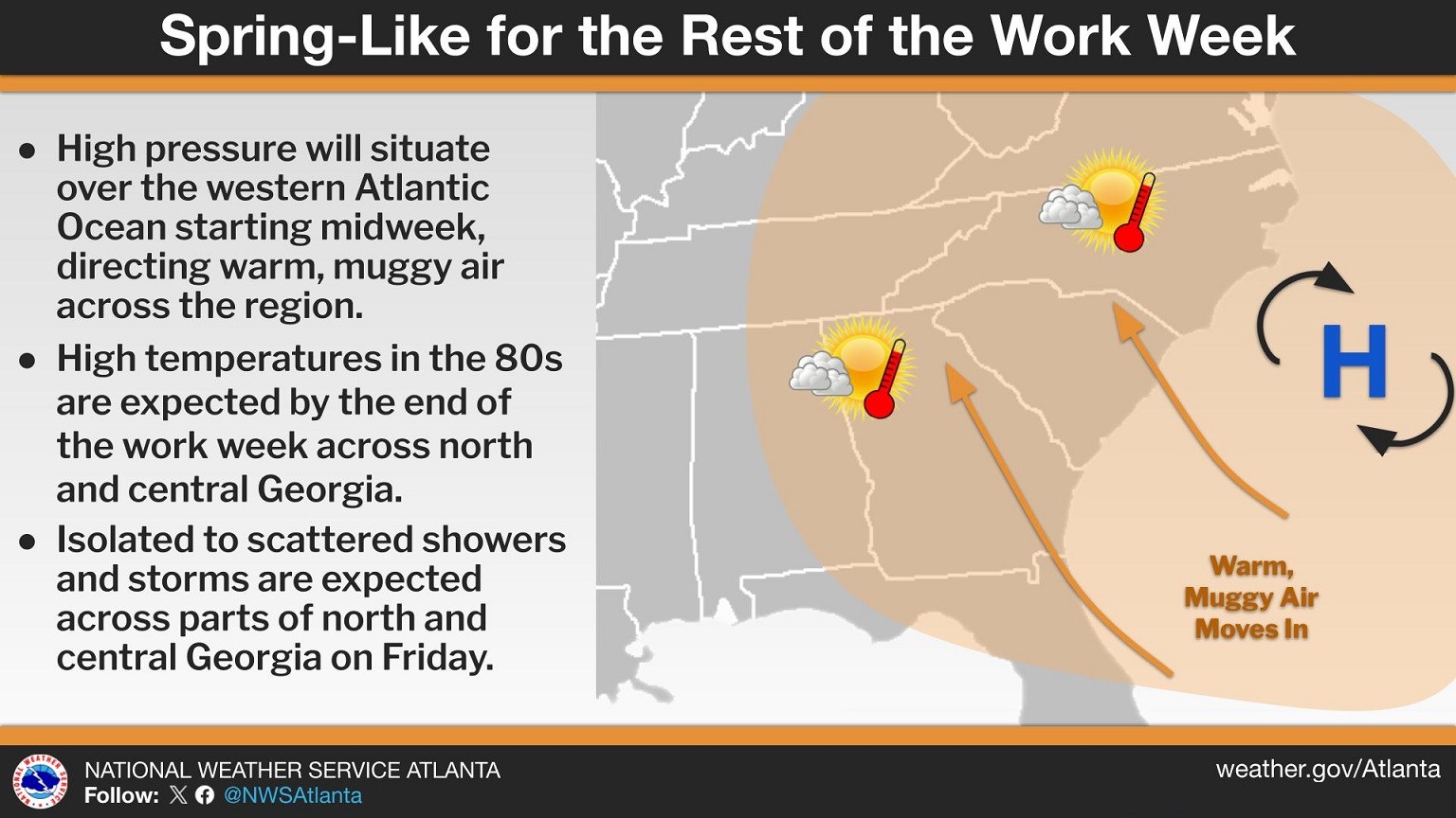
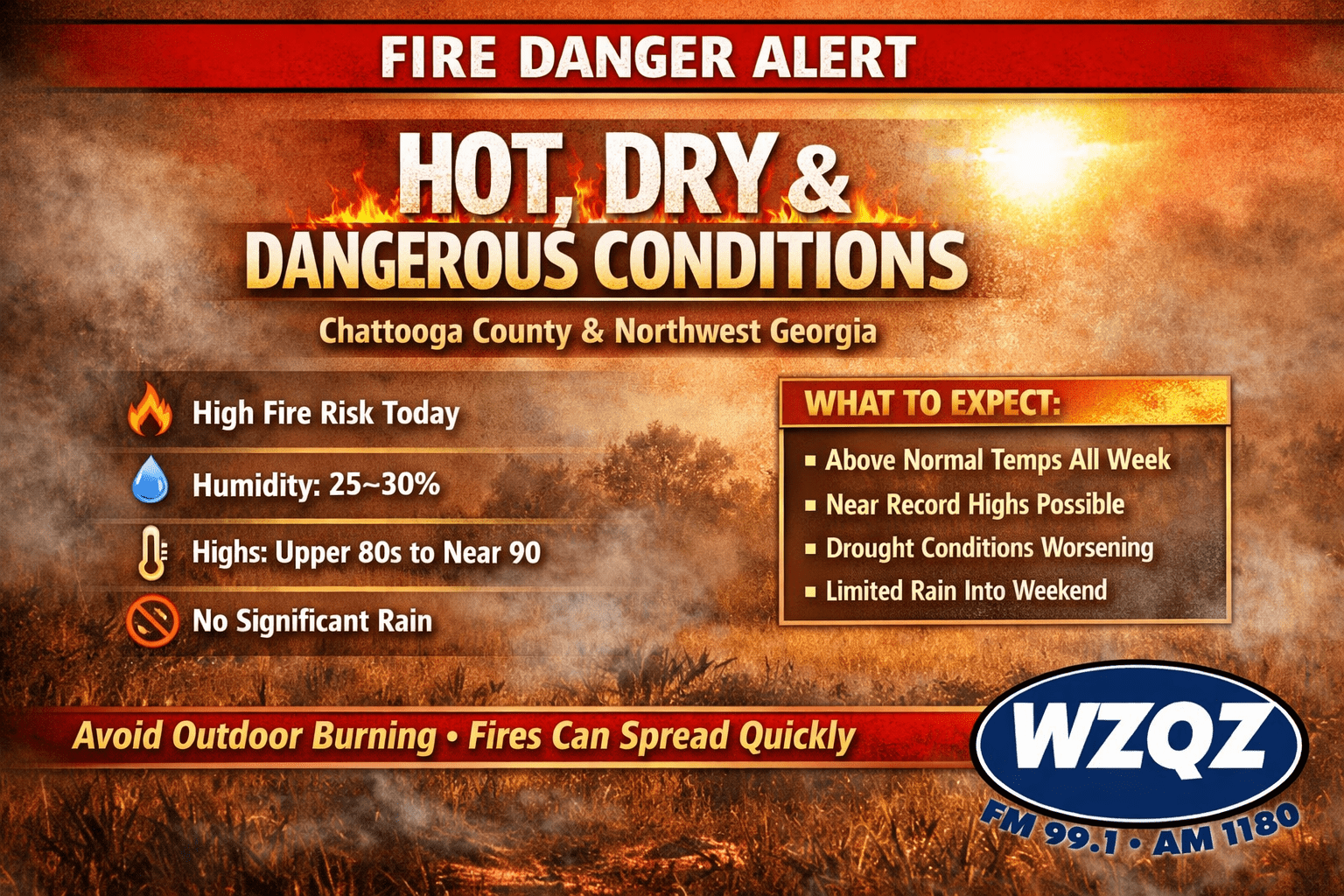
Residents across Chattooga County and Northwest Georgia are waking up to cloudy skies and areas of patchy fog this morning as warm, moist air moves into the region. Forecasters say a weakening wedge of high pressure has shifted toward the Atlantic, forming more of a Bermuda high pattern. This setup is allowing southeasterly winds to bring warmer and more humid air into the area, gradually pushing temperatures well above normal for early March.
Residents across Chattooga County and Northwest Georgia are experiencing an early taste of spring as temperatures climb well above normal for early February. Forecasters say highs will run 10 to 15 degrees above average for the next few days before gradually cooling back toward seasonal levels later this week.
After a mostly quiet start to Friday in Chattooga County, residents should be ready for wet roads and off-and-on showers as rain builds back into Northwest Georgia late today and lasts into Saturday. Forecasters expect clouds to thicken through the afternoon as moisture streams north, setting the stage for showers to spread in late Friday evening and overnight.
Rain chances are set to increase later this morning across Chattooga County and Northwest Georgia, with light to moderate rainfall becoming widespread through the afternoon, according to the National Weather Service in Peachtree City, Georgia.
Unseasonably warm temperatures will continue across Chattooga County and the rest of Northwest Georgia as we head through the weekend and into next week. Forecasters say highs will run about 10 to 15 degrees above normal, and a few record highs may even be challenged across the region.


