


Scattered showers and thunderstorms are expected across north Georgia through the beginning of next week, with locally heavy rainfall remaining the primary weather concern.

Scattered showers and thunderstorms are expected across north Georgia through the beginning of next week, with locally heavy rainfall remaining the primary weather concern.
![]()
A noticeable warm-up is underway across Chattooga County and Northwest Georgia, with springlike heat building Tuesday and daily rain chances settling in through the weekend.
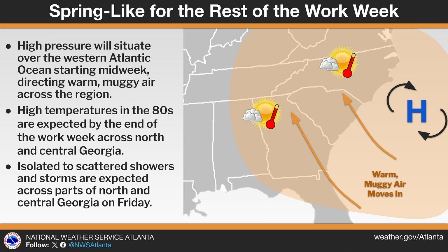
Residents across Chattooga County and Northwest Georgia are waking up to cloudy skies and areas of patchy fog this morning as warm, moist air moves into the region. Forecasters say a weakening wedge of high pressure has shifted toward the Atlantic, forming more of a Bermuda high pattern. This setup is allowing southeasterly winds to bring warmer and more humid air into the area, gradually pushing temperatures well above normal for early March.

Residents across Chattooga County and Northwest Georgia will notice a cooler and cloudier start to the week as a Cold Air Damming (CAD) wedge builds down the East Coast and settles into Northeast Georgia.
Forecasters say mostly clear skies early Monday will quickly give way to increasing cloud cover, especially across Northeast Georgia. The strengthening wedge will push cooler air into the region, holding afternoon highs in the mid-50s in parts of Northeast Georgia. In contrast, areas farther south in Georgia could still see temperatures climb into the mid-70s.
Chattooga County and the rest of Northwest Georgia stay unusually warm today and Wednesday as southwest winds keep moisture and mild air in place. Expect mostly cloudy skies with afternoon highs in the upper 60s to near 70, about 15 degrees above normal for early January. A few isolated, light showers could pop up overnight, but rain chances and amounts look low for now. Winds may get a little gusty at times today, with gusts up to around 20 mph possible across the northern tier of Georgia.
Northwest Georgia is in for a notably mild stretch to start the workweek, with temperatures running 10 to 25 degrees above average across the region.

Unseasonably warm weather continues to dominate the pattern across Chattooga County and the rest of Northwest Georgia, and this trend shows no signs of breaking anytime soon. Temperatures, already well above what is typical for late November, are expected to remain elevated through at least the middle of next week. In fact, several days may come close to setting new record highs as the region remains locked under stubbornly warm air.