


Chattooga County and the rest of Northwest Georgia are facing an extended stretch of dry weather, increasing fire danger, and a significant warm-up heading into the weekend and early next week.

Chattooga County and the rest of Northwest Georgia are facing an extended stretch of dry weather, increasing fire danger, and a significant warm-up heading into the weekend and early next week.
![]()
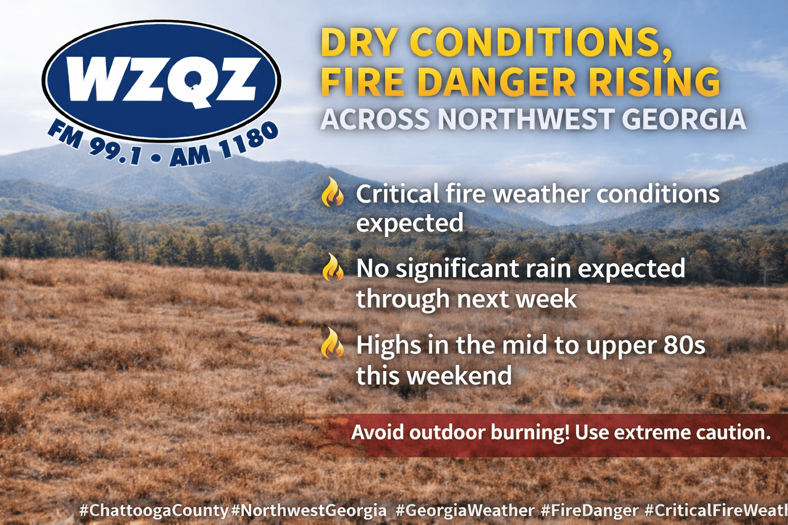
Dry conditions and near-normal temperatures are expected to hold steady across Chattooga County and Northwest Georgia through the remainder of the week, but it’s the fire danger that has officials on alert.
![]()
Sunshine and comfortable temperatures may make it feel like a picture-perfect spring week in Chattooga County, but the dry air and gusty winds are creating serious concerns for fire danger across Northwest Georgia.
![]()
Residents across Chattooga County and Northwest Georgia can expect a stretch of dry, pleasant weather to start the week, but those same conditions are raising concerns about fire danger across the region.
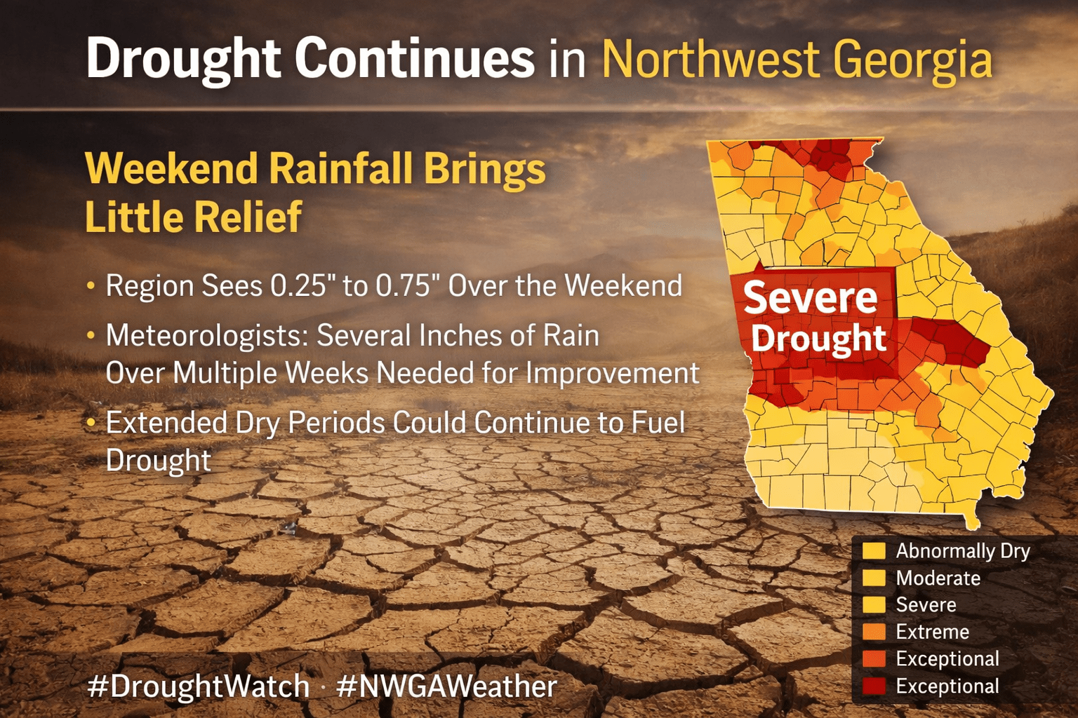
Drought conditions continue to grip Northwest Georgia, including Chattooga County, and this weekend’s round of showers and storms is expected to do little to improve the situation. While some areas picked up between a quarter and three-quarters of an inch of rain, experts say that amount is far below what’s needed to make a meaningful dent in the region’s rainfall deficit.
![]()
Residents across Chattooga County and Northwest Georgia are waking up to a soggy and stormy Easter Sunday as a line of showers and thunderstorms pushes through the region from early morning into the afternoon hours.
![]()
Warm spring air, increasing humidity, and an approaching line of storms will make for an active weather day across Chattooga County and the surrounding Northwest Georgia region.

Drought conditions are continuing across Chattooga County and much of Northwest Georgia, but forecasters say some relief could be on the way as rain chances increase heading into the Easter weekend.
![]()
Rain chances will stay fairly limited today across Chattooga County and the rest of Northwest Georgia, but a wetter pattern is expected to move in as the weekend continues.
![]()
Residents across Chattooga County and Northwest Georgia are waking up to patchy dense fog this morning, with visibility in some areas dropping to as low as half a mile. The fog is expected to linger through about 10 AM, especially in spots that saw rainfall yesterday, before gradually clearing.