Chattooga County and the rest of Northwest Georgia are once again under heightened fire weather concerns as dangerously dry conditions and unusually hot temperatures continue through Saturday.

Chattooga County and the rest of Northwest Georgia are once again under heightened fire weather concerns as dangerously dry conditions and unusually hot temperatures continue through Saturday.
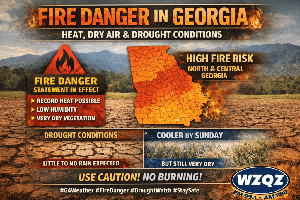
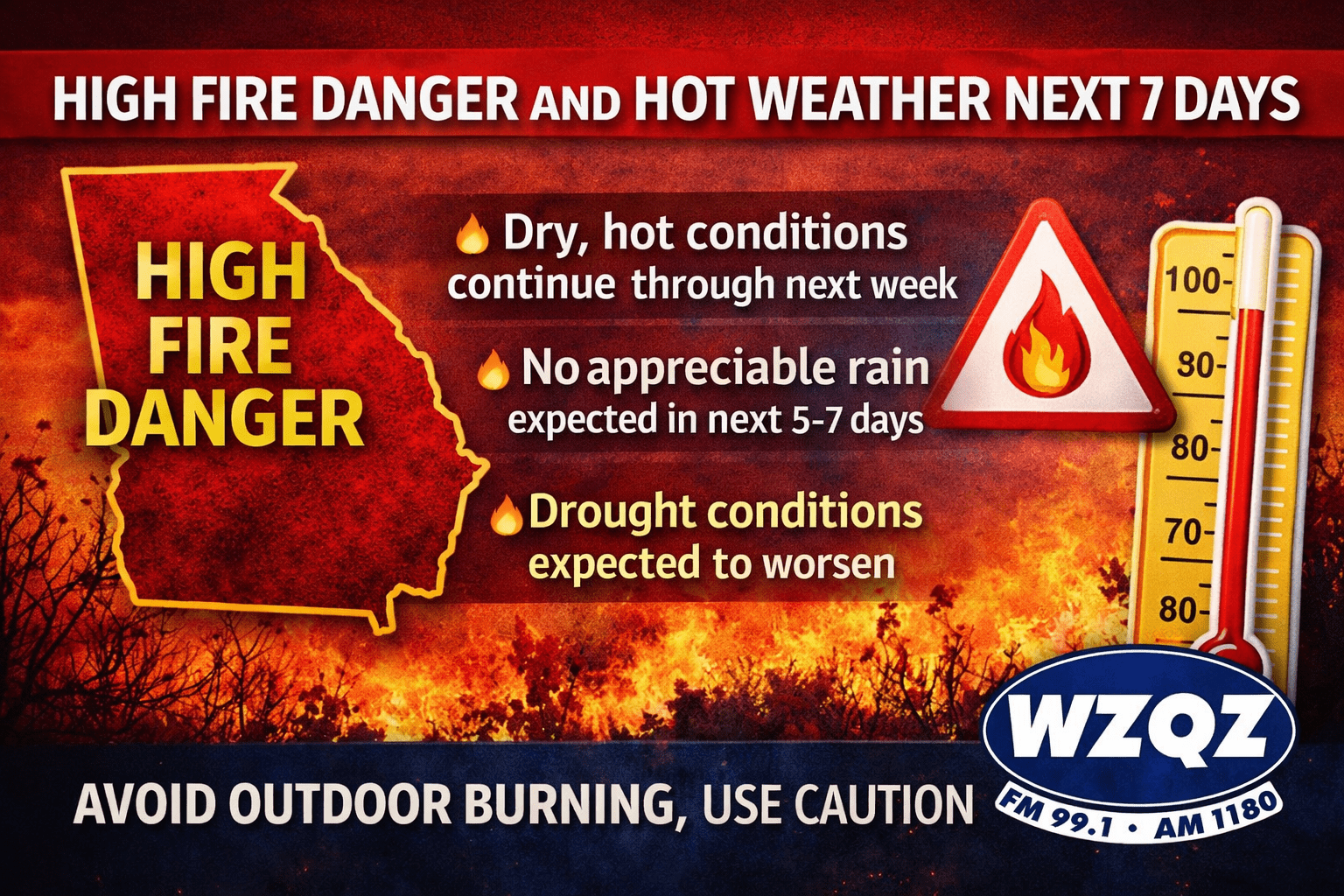
A Fire Danger Statement remains in effect across portions of north and central Georgia as dry vegetation, low humidity, and unusually warm temperatures continue to create dangerous fire weather conditions through the end of the week.

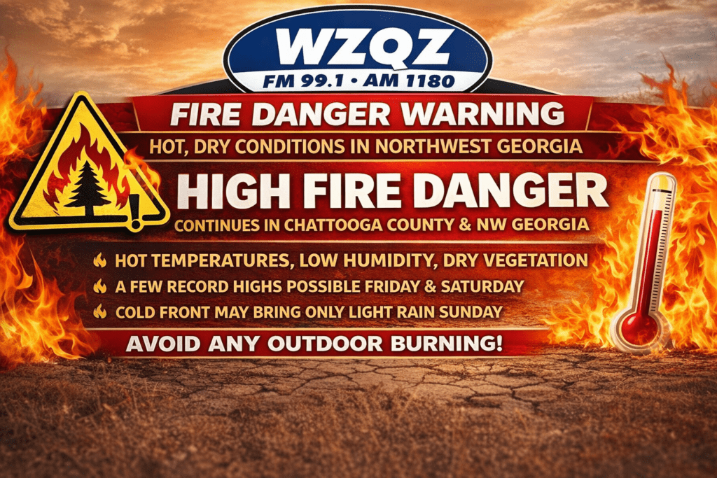
A Fire Danger Statement is in effect this afternoon across Chattooga County and Northwest Georgia as very dry, warm conditions continue to raise wildfire concerns across the region.
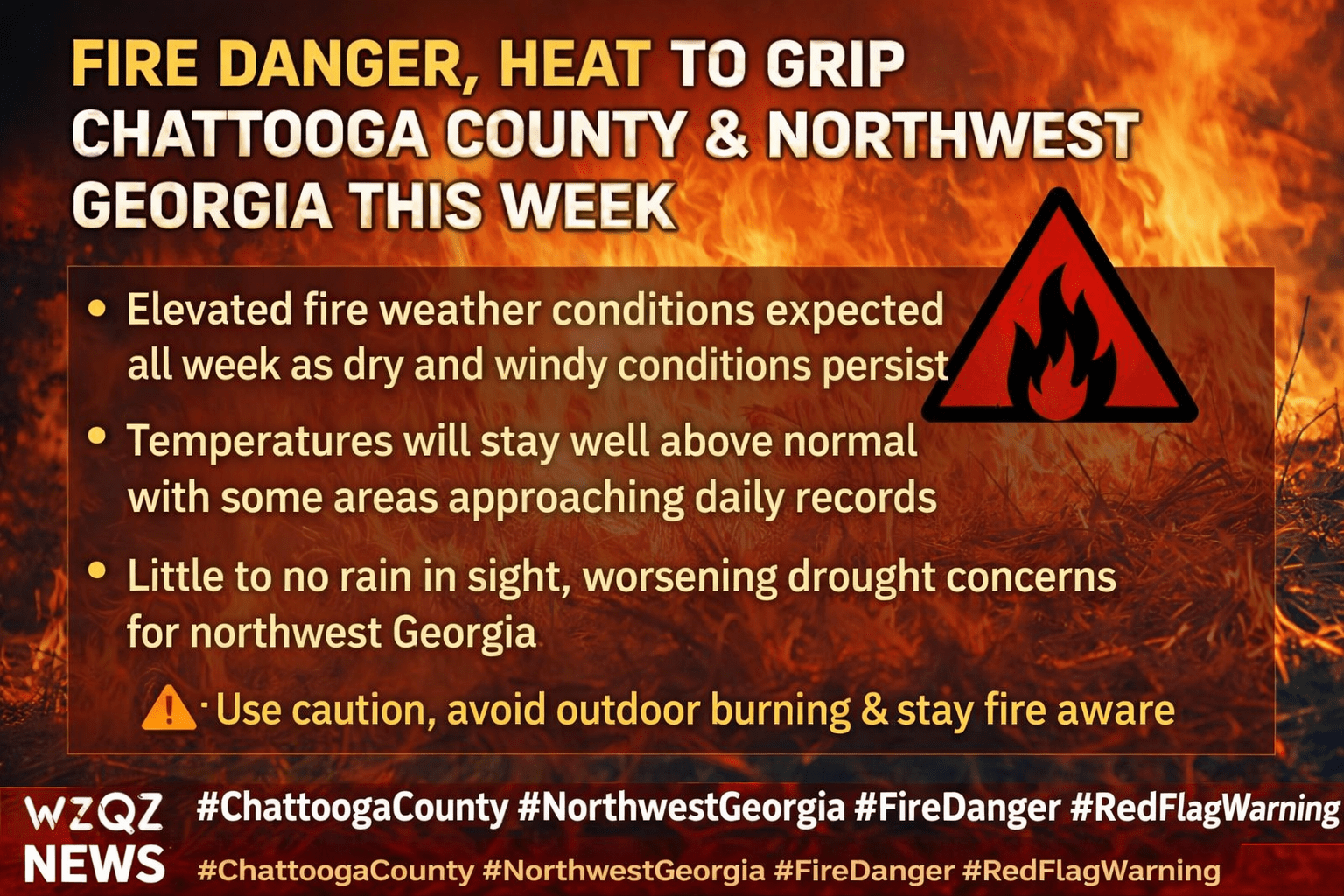
Chattooga County and the rest of northwest Georgia are expected to remain under elevated fire danger conditions this week as dry air, warm temperatures, and gusty winds continue across the region.
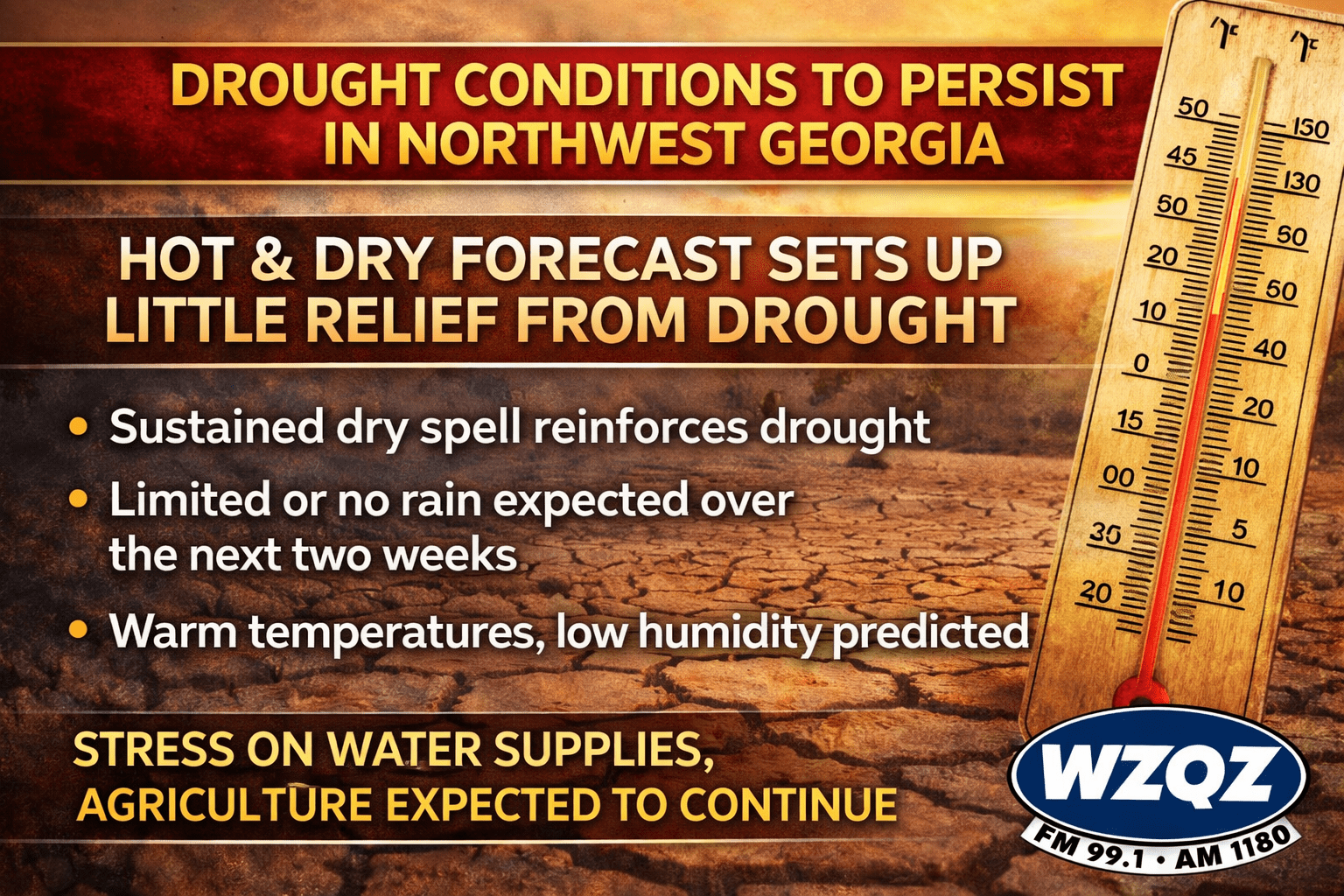
This week’s forecast for Northwest Georgia is raising concerns as continued dry and unusually warm conditions are expected to prolong—and potentially worsen—ongoing drought conditions across the region.
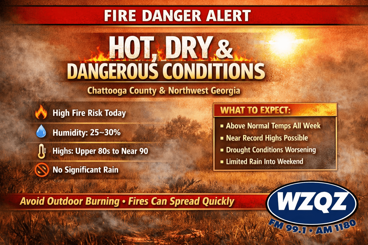
High fire danger conditions are expected to return across Chattooga County and much of Northwest Georgia today as very warm, dry weather continues to grip the region.
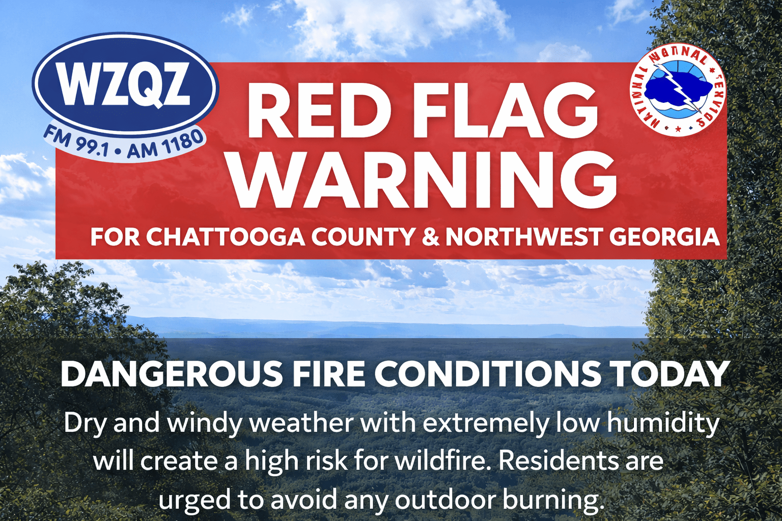
A Red Flag Warning has been issued for far north Georgia, including areas near Chattooga County, from noon through 8:00 p.m. Sunday. Officials say a combination of low humidity, dry vegetation, and breezy winds will create conditions where fires can start easily and spread quickly.
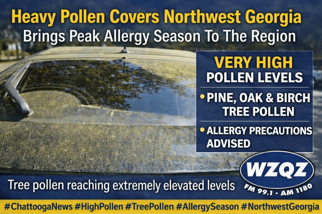
Spring allergy season is in full force across Northwest Georgia, with high pollen levels continuing to impact residents in Chattooga County.
Dry and increasingly hot conditions are expected to continue across North Georgia through the weekend and into next week, raising concerns about wildfire risk and worsening drought conditions.
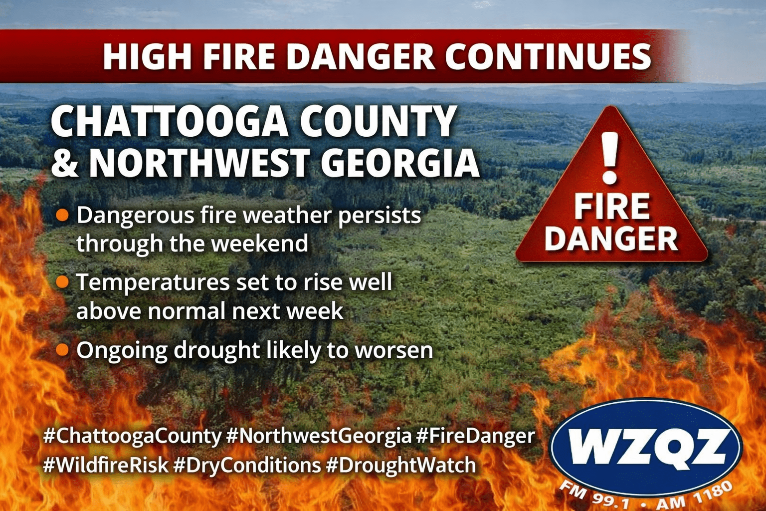
Residents across Chattooga County and the broader Northwest Georgia region should remain on alert as high fire danger conditions persist through the weekend. Dry weather, low humidity, and warming temperatures are creating an elevated risk for wildfire activity.