Chattooga County Commissioner Andy Allen says crews are starting to see minor accumulation on some roads, but nothing serious at this time. He says county work crews are out treating a few locations in the northern end of the county and in higher elevations, and another update is expected later this afternoon.
Snow at Cloudland (5AM) Saturday morning (Photo Credit: Wendy Brown)
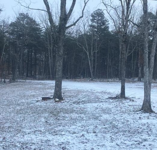
While the heaviest snowfall is expected to remain east of our area, Chattooga, Floyd, and Walker Counties in Northwest Georgia will see light snow showers this morning, according to the National Weather Service in Peachtree City.
Once again, Georgia and much of the Deep South appear headed for a round of winter weather this weekend, but like last weekend, the best chance for frozen precipitation looks to stay mainly east of Chattooga, Floyd, and Walker Counties. The National Weather Service says confidence continues to increase for measurable snowfall across parts of northeast and east-central Georgia between Friday night and Saturday night, prompting a Winter Storm Watch for those areas.
The potential is increasing for another significant winter storm to impact parts of the eastern United States this coming weekend. Forecasters emphasize it is still too early to pin down exact details, but confidence is growing that a storm system could develop and move through while very cold air remains in place.
Meteorologists say a disturbance is expected to move out of Canada later this week, helping a stronger low-pressure system form across the East. If that system tracks in the right corridor, it could bring widespread precipitation that may fall as rain, snow, or a mix, depending on where the coldest air sets up. The biggest uncertainties right now include the storm’s timing, track, and strength, which will determine what areas see the greatest impacts.
For Northwest Georgia and the surrounding region, the message for now is preparedness without panic. Residents should keep checking updated forecasts through the week, especially as we get closer to Friday and Saturday when forecast confidence typically improves. Now is also a good time to review weekend travel plans, make sure you have supplies in case of slick roads or power issues, and plan ahead for pets, pipes, and outdoor needs if colder, wetter conditions move in.
Chattooga County Emergency Management says there are currently no reported road hazards across the county, but residents are urged to stay cautious as wet surfaces may have iced over in spots, especially on porches, driveways, and less-traveled roads.
EMA says Public Works Director Tim Brunson has been checking roads throughout Chattooga County and reports that while main routes appear to be in good shape, some less-traveled roads do have icy spots. If you must travel, officials ask drivers to take it slow, use caution, and allow extra time.
The cold is expected to hang on today, with temperatures possibly not rising above freezing, and wind chills making it feel even colder. Residents who need to be outdoors are encouraged to dress appropriately in layers and limit time outside, as hypothermia can develop quickly in these conditions.
Chattooga County EMA reports that as of 6:00 a.m., the temperature in the county was 22 degrees, with a wind chill of 11 degrees.
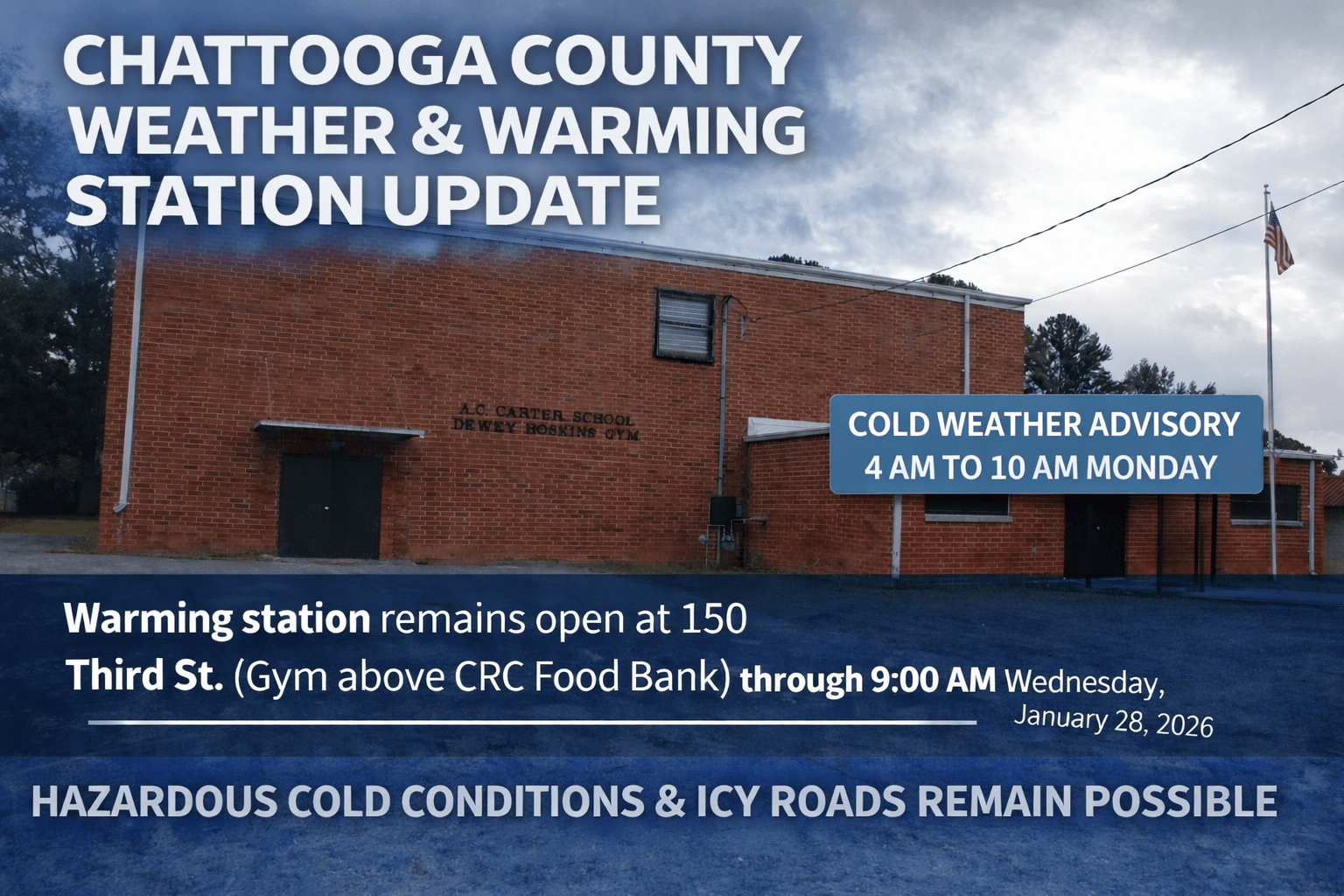
As frigid air settles into Chattooga County behind the weekend rain, volunteers with the Chattooga County Community Resource Center will continue operating a warming station at 150 Third Street in Summerville, located in the gym above the CRC Food Bank.
The warming station will remain available through Wednesday morning, January 28, 2026, and is scheduled to close at 9:00 a.m. that day.
The warming station hours are 5:00 p.m. to 9:00 a.m. Monday and Tuesday. If power outages occur, the site will transition to continuous operation to provide a safe, warm place for those who need it.
Chattooga County Public Works, city maintenance departments, and local law enforcement will continue monitoring road conditions and treating roadways as needed.
Residents are urged to stay weather-aware as dangerously cold conditions will be with us for the next couple of days.
Drivers should use caution if traveling, particularly this evening and overnight as temperatures drop.
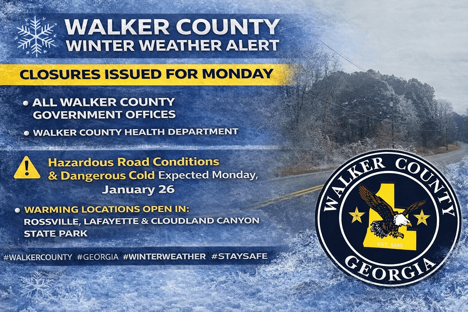
While most of Chattooga County avoided widespread icy conditions on Sunday—aside from some winter precipitation reported on Lookout Mountain—parts of Walker County were hit harder by the winter weather. Officials reported around 200 households without power on Sunday as the system moved through the area.
In response, several warming options were made available. Warming stations opened in Rossville and LaFayette, and Georgia State Parks opened a warming shelter at Cloudland Canyon State Park on Lookout Mountain to help residents needing a warm place during the cold snap.
Because of the continued threat of hazardous travel and dangerously cold temperatures, Walker County Government offices will be closed Monday, January 26. The closure includes county offices as well as the landfill and transit services.
In addition, the Walker County Health Department will also be closed Monday, January 26.
A high-impact winter storm is expected to bring significant icing to Chattooga County and parts of Northwest Georgia this weekend, prompting the National Weather Service to issue an Ice Storm Warning. The warning is in effect from 7:00 AM Saturday until 10:00 AM Monday.
The City of Summerville is preparing ahead of possible freezing conditions this weekend by pre-treating streets with a brine solution to help reduce ice impacts. City officials say all Public Works staff will be available, and snow and ice removal equipment is ready if conditions worsen.
In addition, the North Summerville Gym will be available to the Chattooga Resource Center to operate a warming shelter as needed.
City officials also announced that City Hall will delay opening on Monday until 10:00 a.m. The update was issued by City Manager Jason Winters.