










Chattooga County Schools will revise severe weather procedures at Chattooga High School after consulting with a Georgia Emergency Management and Homeland Security Agency security specialist.

Chattooga County Schools will revise severe weather procedures at Chattooga High School after consulting with a Georgia Emergency Management and Homeland Security Agency security specialist.

Northwest Georgia will remain dry and warm through Friday, but forecasters are closely watching a tropical system in the Gulf that could bring significant rainfall, gusty winds and thunderstorms to the region this weekend.
The National Weather Service says Tropical Depression Nine has formed in the Gulf, although considerable uncertainty remains concerning its eventual track and the extent of its impacts on Georgia.
For Thursday, Chattooga County can expect sunny skies with a high near 87 degrees. Thursday night will be mostly clear with a low around 58.
Friday will remain mostly sunny with a high near 85, but conditions could begin changing Friday night as moisture associated with the tropical system moves northward. A slight chance of showers develops after 2 AM.
Rain chances increase to 50% Saturday, with a high near 75. Showers become likely Saturday night, when thunderstorms will also be possible and rain chances increase to 70%.
Showers are likely again Sunday, with thunderstorms possible during the afternoon. Sunday’s high will be near 74 degrees, with a 70% chance of precipitation.
The National Weather Service says current projections indicate one to three inches of rainfall could fall across portions of north and central Georgia, although amounts will depend heavily on the eventual track of the tropical system.
Forecasters say sustained winds around 15 mph with gusts potentially reaching 25 to 30 mph are also possible. Heavy rainfall could produce localized flash flooding and rises along rivers, creeks and streams.
There could also be a tornado threat depending on the system’s eventual track and strength.
Forecasters emphasize that considerable uncertainty remains regarding the timing, location and intensity of the system. Residents are encouraged to monitor updated forecasts as the weekend approaches.
Conditions should gradually improve early next week as the tropical system weakens and a drier air mass moves into the region.

The Georgia State Patrol is adding a different type of vehicle to its familiar fleet of patrol cars and SUVs — Ford Broncos equipped for off-road emergency response.
Chattooga County will close out September with sunshine and temperatures well above normal, but a major change in the weather pattern is expected by the weekend.
The National Weather Service says Wednesday will be sunny with a high near 89 degrees. Winds will be light, becoming southeast around 5 mph during the afternoon. Wednesday night will be mostly clear with a low around 61.
Forecasters say Wednesday’s temperatures across the region will run approximately 8 to 12 degrees above normal for the final day of September.
The warm weather continues Thursday with sunshine and a high near 90. Friday could be even warmer, with a high near 91 before moisture begins returning to the area. A 30% chance of showers develops Friday afternoon, increasing to 50% Friday night.
A much wetter pattern is expected for the weekend.
The chance of rain increases to 70% Saturday, with showers likely and thunderstorms possible during the afternoon. Rain chances climb to 80% Saturday night and Sunday.
The National Weather Service says Sunday will need to be watched for the possibility of stronger thunderstorms as a weather system moves through the region. Forecasters caution that details concerning the strength of the storms could change as the weekend gets closer.
Heavy rainfall could also become a concern. Current guidance indicates several inches of rain could be possible from Friday into early next week, potentially creating a risk of flash flooding in parts of north Georgia.
Temperatures will turn noticeably cooler behind the system. Sunday’s high is forecast near 78, followed by highs around 76 Monday and 74 Tuesday.
Sunshine and warmer temperatures are expected across Chattooga County Tuesday as dry high pressure remains in control of the weather.
After several days of summerlike heat, Northwest Georgia will finally get its first real taste of fall today, but the change in temperatures could come with showers and thunderstorms.
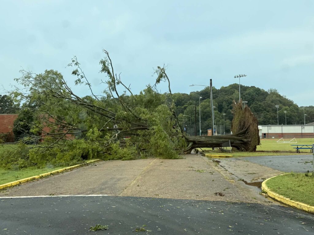
The damaging storm that struck Trion Monday afternoon was not a tornado, according to the National Weather Service, but rather a downburst, likely a wet microburst, capable of producing winds estimated at 60 to 70 mph.

Another hot and unsettled day is expected across Chattooga County and Northwest Georgia today, but a significant change toward more seasonable late-September weather is on the way.
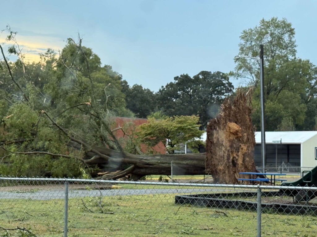
Trion residents are cleaning up this morning following a strong thunderstorm that caused widespread damage across the town Monday evening.
Trion Police Chief David Gilleland told WZQZ News Monday night that the damage was extensive, with numerous trees and limbs brought down across town.
Damage was reported in front of Mount Vernon Mills and along Simmons Street, Town Hall Drive, Marsh Avenue and Pine Street, as well as several other locations. Crews had already cleared the area in front of the mill when Gilleland spoke with WZQZ shortly before 7:45 PM.
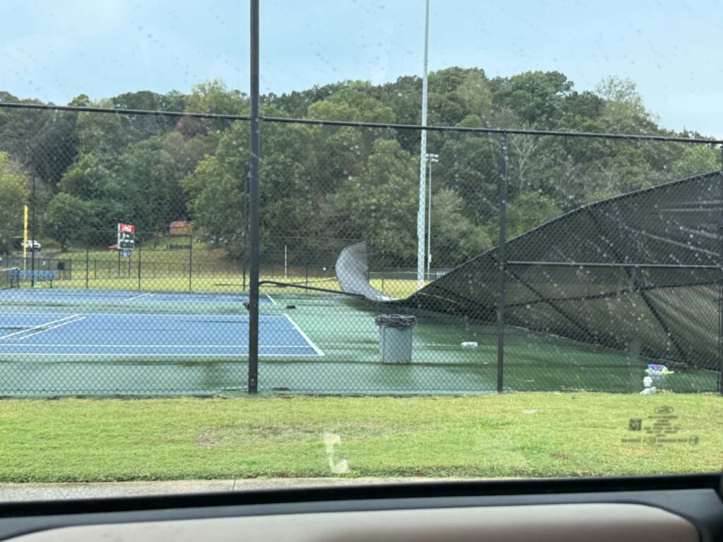
One of the more significant areas of damage was at the Trion Recreation Department, where a large tree came down near the tennis courts.
Gilleland told WZQZ the falling tree took out the entire fence surrounding the tennis courts.
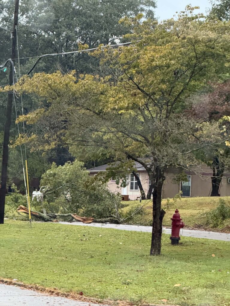
Some residents along side streets also experienced power outages Monday evening, although power remained on at Trion School following the storm.
Most importantly, Gilleland said no injuries had been reported as of Monday night.
Photos taken around Trion following the storm showed large trees and limbs down near homes and along roadways.
There was no immediate confirmation that a tornado was responsible for the damage. The storms that moved through the area were capable of producing strong, damaging wind gusts.
Crews were working Monday evening to clear trees and debris and assess the extent of the damage.
Unseasonably warm weather will continue across Chattooga County and Northwest Georgia through Tuesday, with another round of afternoon thunderstorms possible before cooler, drier air arrives later in the week.