


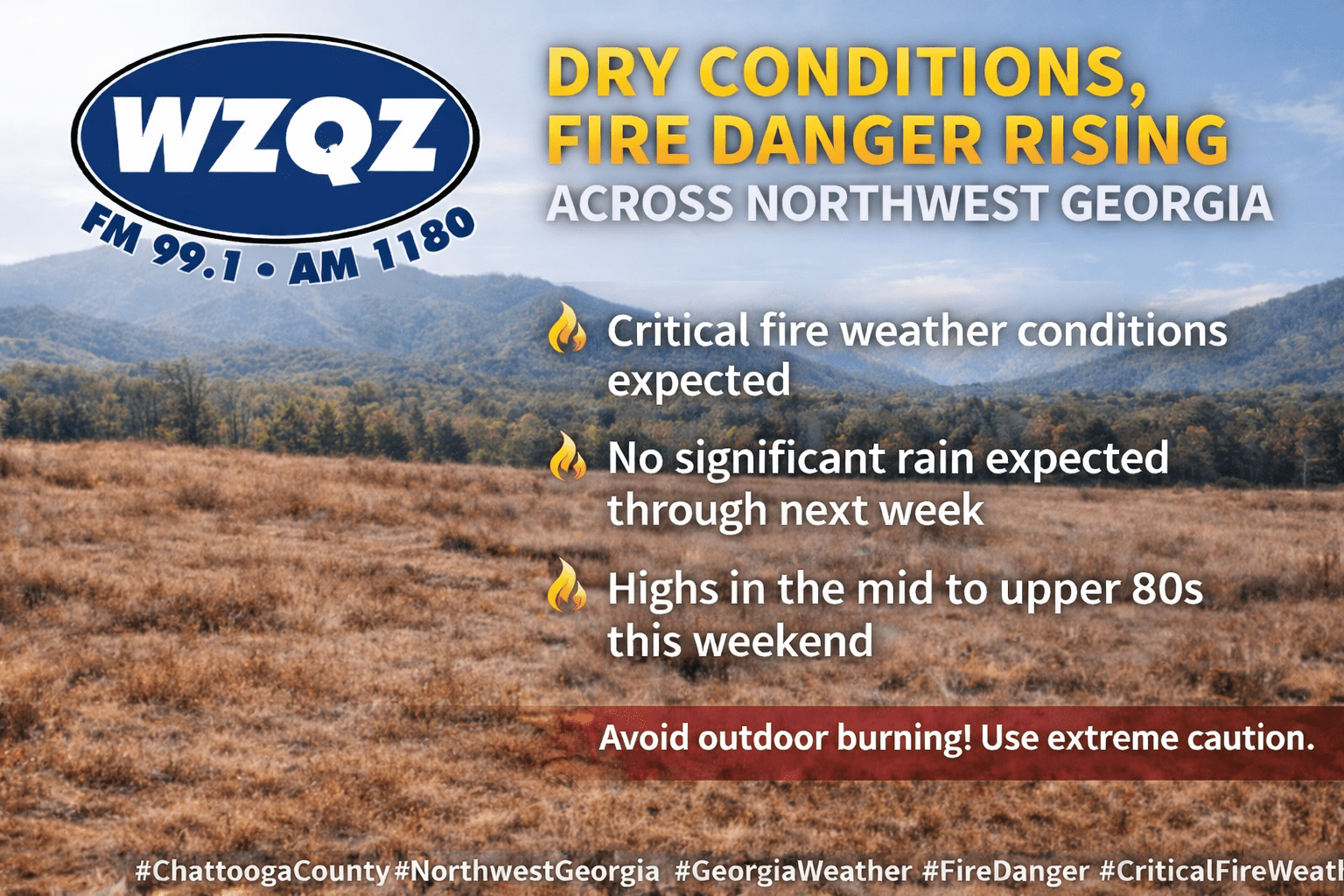
Chattooga County and the rest of Northwest Georgia are facing an extended stretch of dry weather, increasing fire danger, and a significant warm-up heading into the weekend and early next week.

Chattooga County and the rest of Northwest Georgia are facing an extended stretch of dry weather, increasing fire danger, and a significant warm-up heading into the weekend and early next week.
![]()
Residents across Chattooga County and Northwest Georgia can expect a stretch of dry, pleasant weather to start the week, but those same conditions are raising concerns about fire danger across the region.
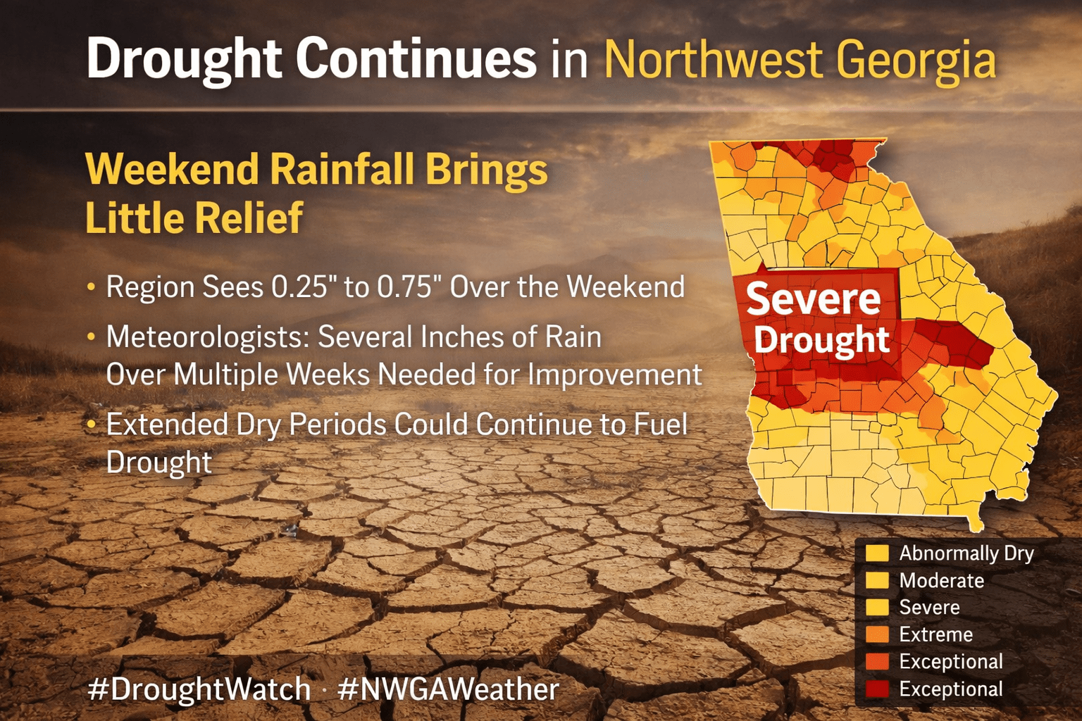
Drought conditions continue to grip Northwest Georgia, including Chattooga County, and this weekend’s round of showers and storms is expected to do little to improve the situation. While some areas picked up between a quarter and three-quarters of an inch of rain, experts say that amount is far below what’s needed to make a meaningful dent in the region’s rainfall deficit.
![]()
Residents across Chattooga County and Northwest Georgia are waking up to a soggy and stormy Easter Sunday as a line of showers and thunderstorms pushes through the region from early morning into the afternoon hours.
Residents across Chattooga County and Northwest Georgia are waking up to cloudy skies and areas of patchy fog this morning as warm, moist air moves into the region. Forecasters say a weakening wedge of high pressure has shifted toward the Atlantic, forming more of a Bermuda high pattern. This setup is allowing southeasterly winds to bring warmer and more humid air into the area, gradually pushing temperatures well above normal for early March.

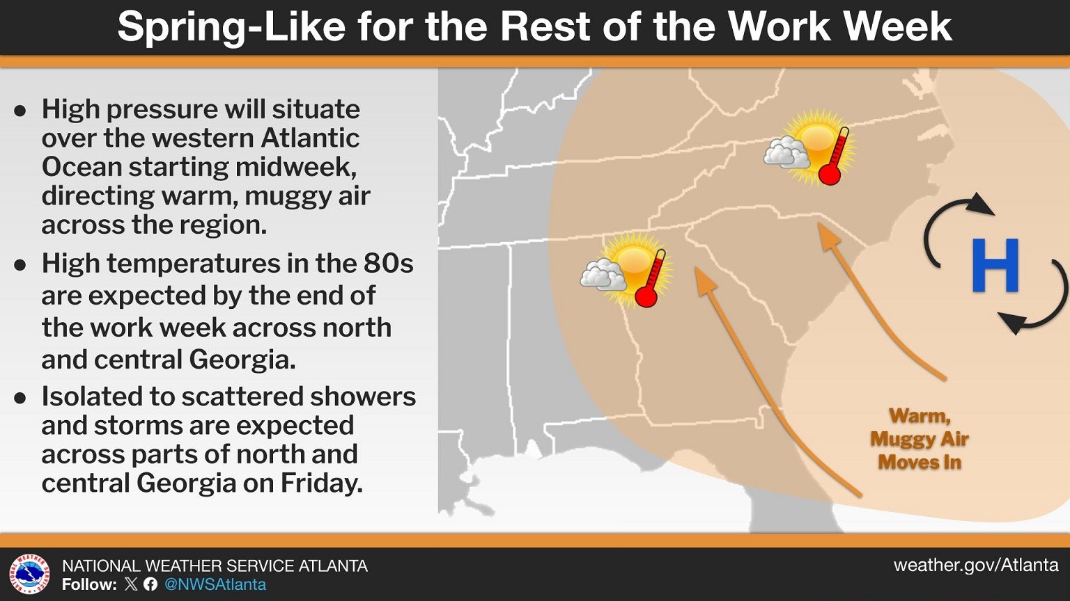
Residents across Chattooga County and Northwest Georgia can expect average to slightly above-average temperatures to continue through the weekend, along with several opportunities for rainfall and a few thunderstorms heading into Thursday and Friday.
Breezy northwest winds and a sharp drop in temperatures are impacting Chattooga County and much of Northwest Georgia today, with colder air expected to linger through Monday.
The National Weather Service has issued a Wind Advisory from 8 a.m. to 7 p.m. EST Sunday as a tight pressure gradient between a developing Nor’easter and high pressure over the Plains drives strong northwest winds across Georgia.
![]()
Chattooga County and the rest of Northwest Georgia will enjoy dry and mild conditions through Saturday, with afternoon highs generally reaching the 60s. Higher elevations may remain in the 40s and 50s, but overall temperatures will stay above seasonal averages.
Residents across Chattooga County and Northwest Georgia are experiencing an early taste of spring as temperatures climb well above normal for early February. Forecasters say highs will run 10 to 15 degrees above average for the next few days before gradually cooling back toward seasonal levels later this week.
Light Rain Returns Tonight for Chattooga County and Northwest Georgia, With a Low-Confidence Winter Storm Signal This Weekend