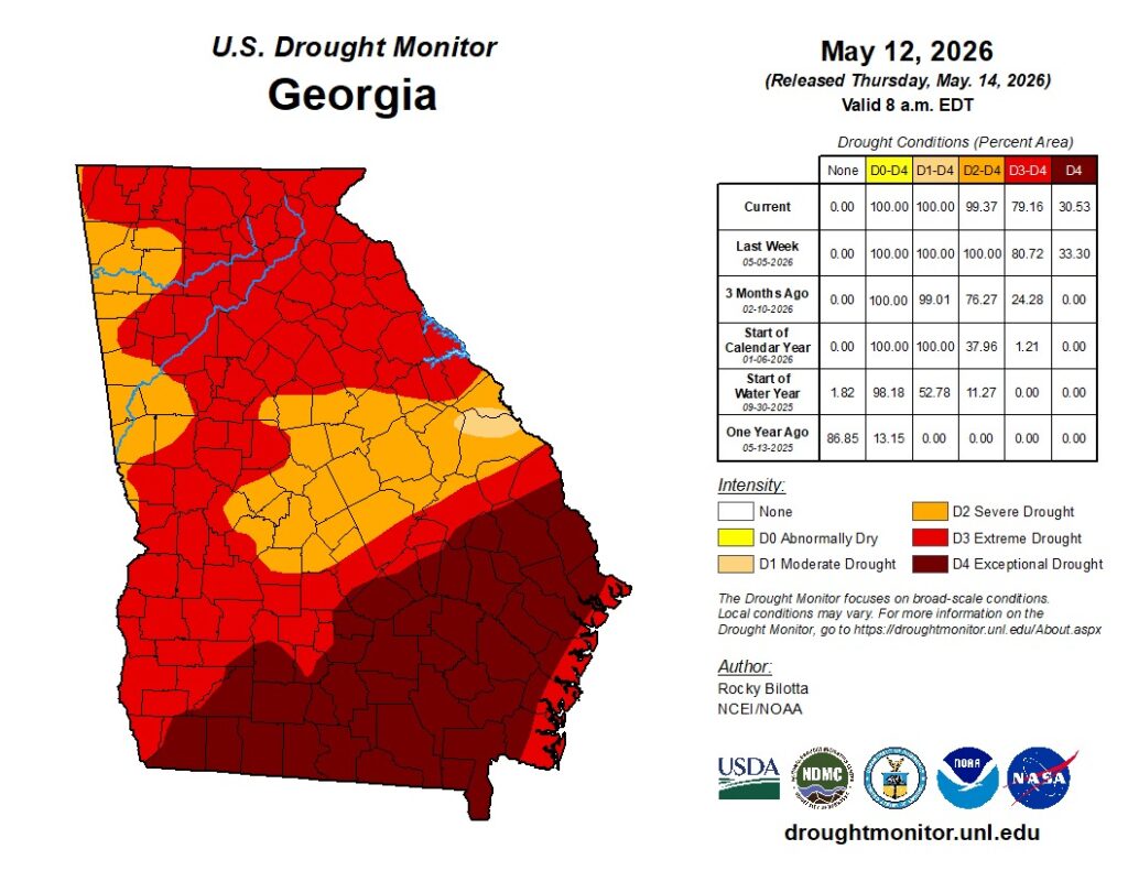
Even with several rounds of recent rainfall across northwest Georgia, drought conditions continue to grip Chattooga County and much of the Southeast.
According to the latest U.S. Drought Monitor, Chattooga County remains in drought conditions, with officials saying recent rain has provided only limited relief to extremely dry soil and low streamflow levels.
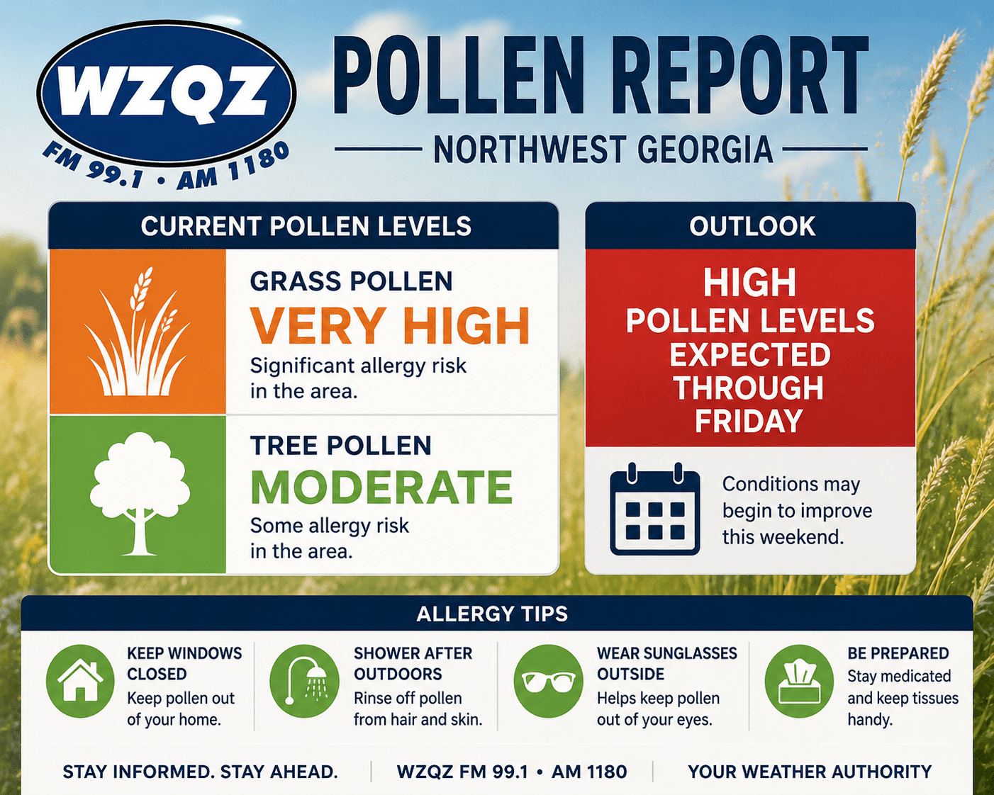
Weather experts say the region remains well below normal rainfall totals over the past several months, and ongoing dry conditions have continued to elevate wildfire danger across Georgia and neighboring states.
The National Drought Mitigation Center reports that much of Georgia remains in moderate to severe drought categories despite scattered rain events in recent weeks. Forecasters say isolated showers may temporarily improve surface conditions, but more widespread and sustained rainfall will be needed before meaningful drought recovery occurs.
Recent dry weather has also contributed to elevated fire weather concerns across north Georgia, with low humidity and dry vegetation increasing the risk for brush fires and wildfires.
Meteorologists say warmer temperatures expected over the coming days could worsen evaporation rates and place additional stress on already dry ground conditions.