










Northwest Georgia will enjoy a mostly sunny and seasonable Wednesday before rain and thunderstorm chances increase heading into Thursday.

Northwest Georgia will enjoy a mostly sunny and seasonable Wednesday before rain and thunderstorm chances increase heading into Thursday.
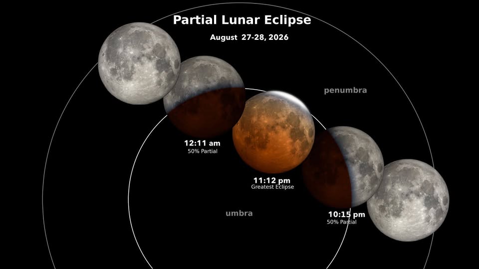
A very deep partial lunar eclipse will be visible over Georgia on the night of Thursday, August 27, into early Friday, August 28, 2026.
This is an unusually impressive partial eclipse. At maximum, about 96% of the Moon’s disk will be inside Earth’s dark central shadow, known as the umbra. It won’t technically be a total lunar eclipse, but visually it may come close to resembling one, with much of the Moon potentially taking on a coppery-red or reddish-orange color.
All of Georgia will be in an excellent position to see the eclipse, weather permitting. Unlike some eclipses that occur near moonrise or moonset, the Moon will be well up in the sky during the best part of this event.
Around maximum at 12:12 a.m. Eastern Time Friday, the Moon will be roughly 40 to 42 degrees above the southern horizon across much of Georgia, including areas such as Atlanta, Rome and Athens. That means you won’t need a perfectly unobstructed horizon — just a reasonably open view of the sky.
If you don’t want to stay up for the entire event, the key viewing window will be from about 11:15 p.m. Thursday until 12:45 a.m. Friday. The most dramatic appearance should occur around the maximum at 12:12 a.m.
And the good news: no special glasses are needed for a lunar eclipse. It is completely safe to watch with the naked eye. Binoculars or a telescope can make the changing colors and the edge of Earth’s shadow even more impressive.
Chattooga County and much of Northwest Georgia will enjoy another mostly dry and pleasant late-summer day today, but showers and thunderstorms will make a return later this week.
Northwest Georgia will enjoy a relatively dry and comfortable start to the workweek, but increasing moisture and an approaching cold front will bring a better chance for showers and thunderstorms by the middle and latter part of the week.

The Chattooga County Agricultural Fair opens later this week, and while temperatures are looking fairly typical for late August, fairgoers may want to keep an eye on the forecast as showers and thunderstorms could affect portions of the four-day event.
Northwest Georgia will enjoy a break from the oppressive humidity Sunday as a secondary cold front pushes through the state, bringing drier air and lower dewpoints to the region.
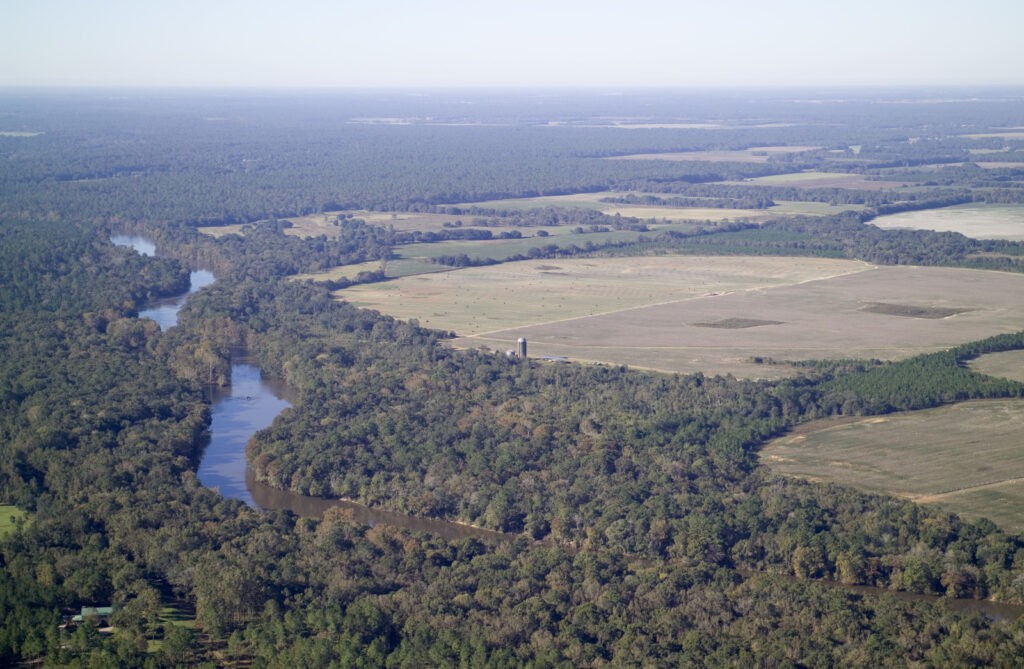
After months of severe drought that brought dry pastures, stressed crops and concerns over water supplies, Georgia has experienced a dramatic turnaround — and Northwest Georgia is among the areas seeing substantial improvement.
Residents across Chattooga County and Northwest Georgia can look forward to a noticeably more comfortable weekend as drier air moves into the region, bringing plenty of sunshine, lower humidity and cooler nighttime temperatures.
Northwest Georgia will get through one more hot and humid day Friday before a front brings noticeably drier and somewhat more comfortable weather for the weekend.
Hot and humid weather will take center stage across Chattooga County and Northwest Georgia Thursday, August 20, with the National Weather Service also watching for the possibility of strong to severe thunderstorms later in the day and overnight.