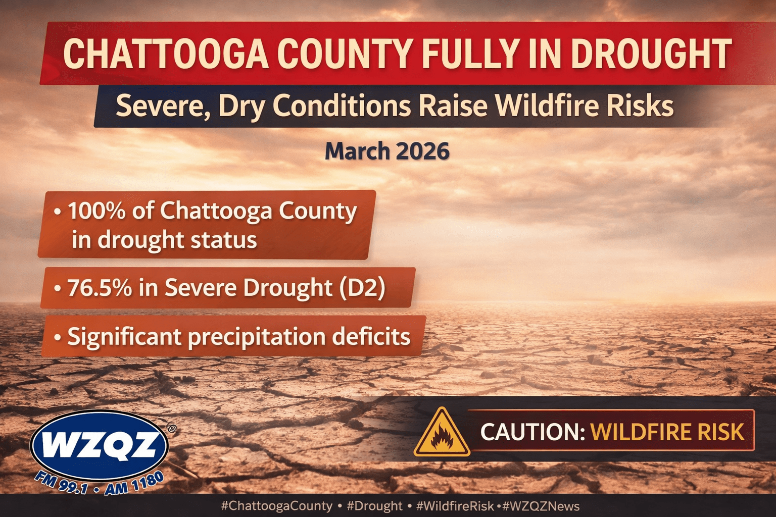
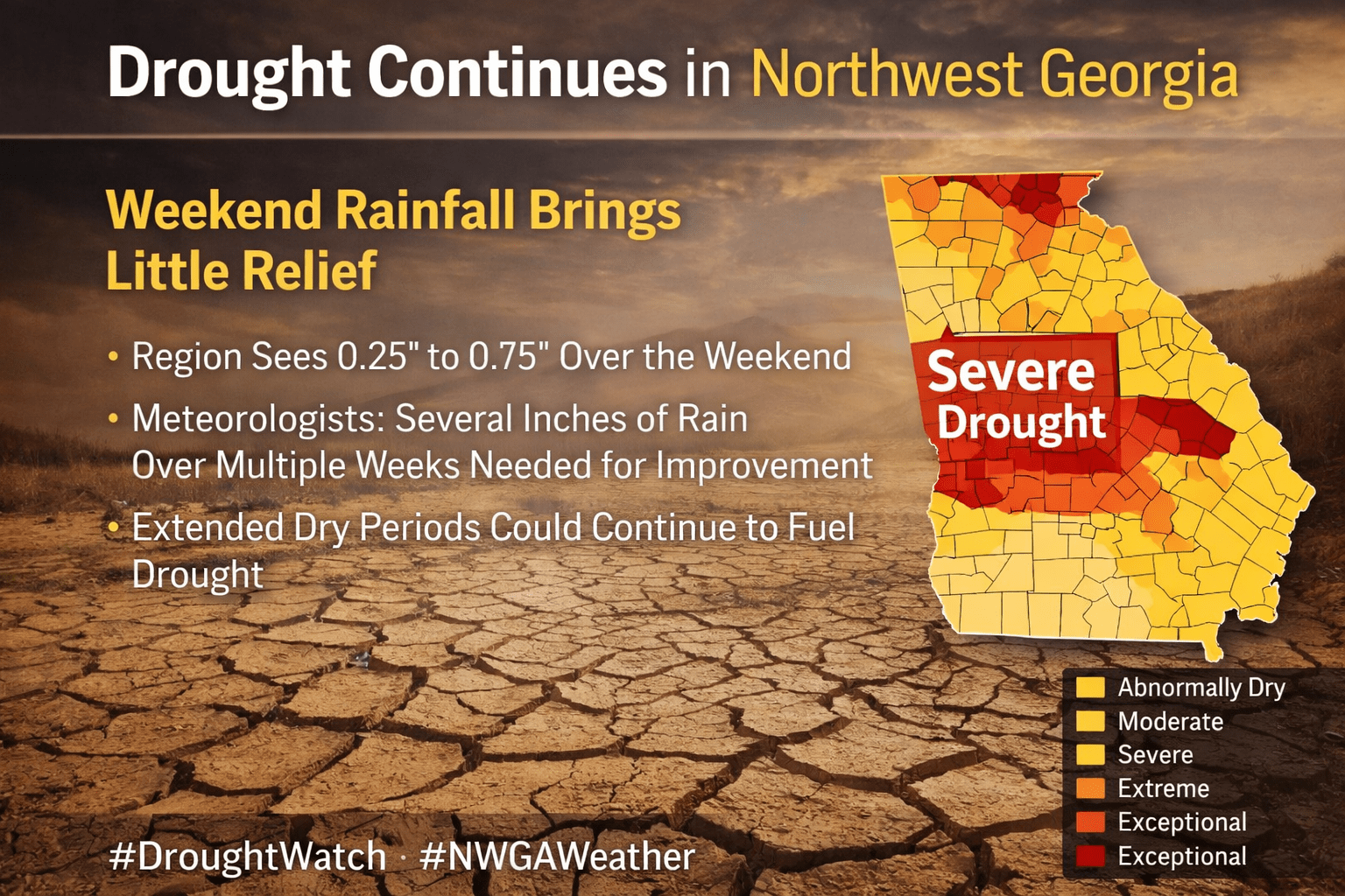
Residents across Chattooga County and the Northwest Georgia region should expect another round of scattered showers and thunderstorms this afternoon, though forecasters say severe weather is not expected at this time.
Residents across Chattooga County and Northwest Georgia are experiencing temperatures that feel more like early summer than early March, with forecasters warning that temperatures could remain 15 to 20 degrees above normal through the coming days.
Residents in Chattooga County and across Northwest Georgia can expect a stretch of unseasonably warm weather heading into the weekend and early next week, with temperatures running 15 to more than 20 degrees above normal for early March.
Residents across Chattooga County and Northwest Georgia will notice a cooler and cloudier start to the week as a Cold Air Damming (CAD) wedge builds down the East Coast and settles into Northeast Georgia.
Forecasters say mostly clear skies early Monday will quickly give way to increasing cloud cover, especially across Northeast Georgia. The strengthening wedge will push cooler air into the region, holding afternoon highs in the mid-50s in parts of Northeast Georgia. In contrast, areas farther south in Georgia could still see temperatures climb into the mid-70s.
Widespread showers and a few isolated thunderstorms will continue across Chattooga County and Northwest Georgia today and into tonight as a cold front tracks south through the region. Early activity has included occasional lightning, but storms have remained scattered and disorganized with no strong or organized severe threat showing up in the near-term pattern.
Chattooga County and the broader Northwest Georgia region are expected to see widespread showers and thunderstorms today and tonight as a cold front pushes through the state.
Above-average temperatures will continue across Chattooga County and Northwest Georgia this week, with the warmest weather expected on Thursday and Friday. Afternoon highs are forecast to reach the upper 60s and low 70s through midweek, then climb into the 70s by the end of the week, making it feel more like early spring than mid-February.
Chattooga County and the rest of Northwest Georgia will enjoy dry and mild conditions through Saturday, with afternoon highs generally reaching the 60s. Higher elevations may remain in the 40s and 50s, but overall temperatures will stay above seasonal averages.
Residents across Chattooga County and Northwest Georgia will see a damp start to Wednesday, followed by unseasonably warm temperatures through the rest of the week before a stronger weather system brings widespread rain this weekend.
Residents across Chattooga County and Northwest Georgia will continue to experience unusually warm February weather this week, with temperatures climbing well above seasonal averages. Highs are expected to peak today and Wednesday, reaching the upper 60s to mid-70s across the region.


