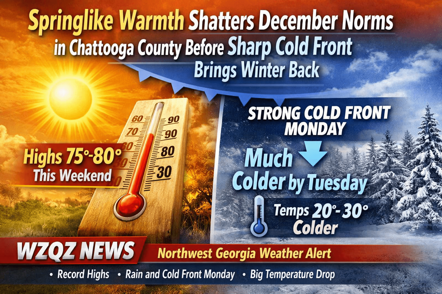
A cold front is pushing into Northwest Georgia this morning, bringing periods of light, hit-or-miss showers as it advances south and east. In Chattooga County, the pattern favors scattered rain that becomes more broken and less organized through the day, with rainfall amounts generally staying on the lighter side. Temperatures will remain chilly but typical for mid-January, with afternoon readings mainly in the 50s across much of Northwest Georgia outside of the higher terrain.
Light Rain Returns Tonight for Chattooga County and Northwest Georgia, With a Low-Confidence Winter Storm Signal This Weekend
Cloudmont Ski Resort Watching Weather, Optimistically Targeting Saturday Opening on Lookout Mountain
Cloudmont Ski Resort on Lookout Mountain in Mentone, Alabama says it’s watching conditions closely and, if the weather cooperates, is optimistically aiming for an opening day this Saturday, January 17. The resort plans to open at 9:00 a.m. Central Time.
A fresh blast of arctic air is sliding into Northwest Georgia, and Thursday morning (Jan. 15) is shaping up to be the coldest stretch of the week for Chattooga County and surrounding communities. Forecasters say biting wind chills between 0° and 15°F are expected across north Georgia as breezy northwest winds follow a passing cold front, making it feel far colder than the thermometer suggests.
A noticeably cooler and drier pattern is settling over Georgia to start the week, bringing brisk mornings to Chattooga County and Northwest Georgia while also fueling heightened fire-danger concerns elsewhere in the state today and Tuesday.
Unseasonably warm, spring-like weather is firmly in place across Chattooga County and Northwest Georgia, with temperatures running 15 to 25 degrees above normal through the weekend. Forecasters say today will likely be the warmest day, with highs soaring into the mid to upper 70s, and a few spots across the region flirting with 80 degrees—levels more typical of late spring than late December.
Residents across Chattooga County and Northwest Georgia are waking up to the coolest morning temperatures they’ll feel for at least the next week, with early Saturday lows in the upper 20s to low 30s. After that chilly start, Saturday turns sunny and pleasant, with afternoon highs climbing into the upper 50s to low 60s.
A Cold Weather Advisory remains in effect across Chattooga County and Northwest Georgia this Monday morning as a blast of Arctic air sends temperatures plunging into the teens, with wind chill values in the single digits in some locations. The coldest readings are expected in low-lying and rural areas, where residents may feel the harshest impacts during the early morning hours.
An arctic blast is headed for Chattooga County early next week, and forecasters say temperatures could plunge into the teens, with wind chills making it feel even colder in some areas. The dangerous drop in temperatures raises concerns not only for people but also for outdoor pets, and local officials and animal-welfare groups are urging residents to take immediate steps to prepare.
Chattooga County and northwest Georgia will remain mostly dry through the end of next week, with no significant rainfall expected. Clear skies and low humidity will allow temperatures to drop into the 30s overnight, while afternoons warm quickly under sunshine.


