Arctic Start to the Week; Fire Danger Builds Tuesday, Widespread Rain Returns Late Week

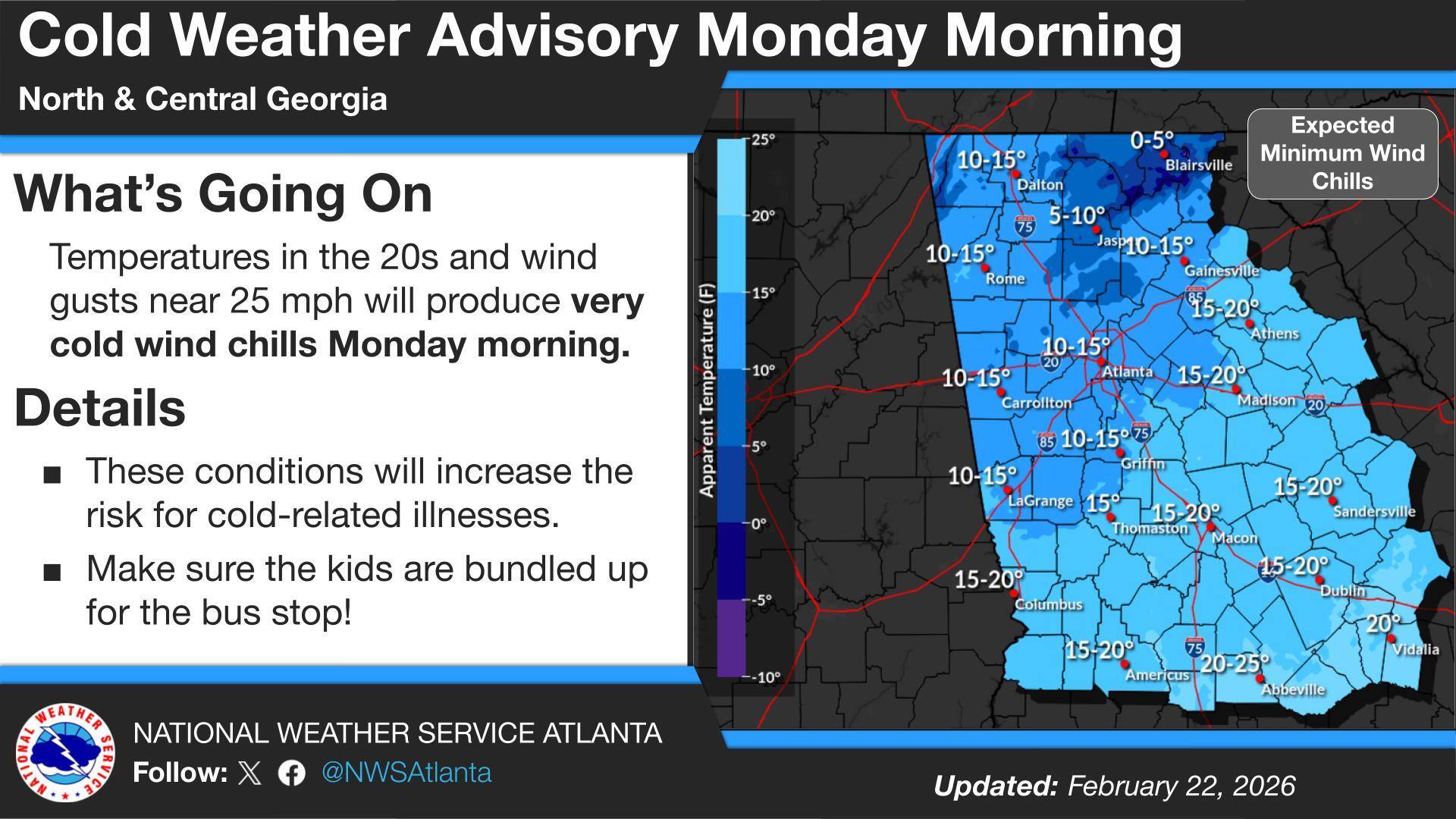
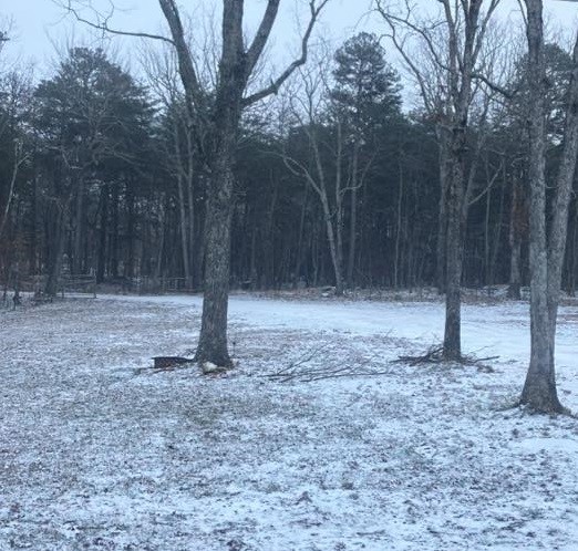
Northwest Georgia is getting the coldest day of the week today as strong northwesterly winds keep a sharp chill in place even with sunshine overhead. Morning wind chills across Chattooga County and surrounding communities are running in the teens, with the coldest spots in the region dipping into the single digits, especially in higher elevations. High temperatures this afternoon will stay mostly in the 40s locally, while the mountains hold in the 30s, and it will still feel wintry through the day as breezy conditions continue.

Read more

Cold Weather Advisory Issued for Chattooga County; Wind Advisory Continues Through Sunday Evening

Residents across Chattooga County and Northwest Georgia are facing a double dose of winter weather as a Wind Advisory remains in effect until 7 p.m. Sunday, followed by a Cold Weather Advisory from 1 a.m. to 10 a.m. Monday.

Read more

Wind Advisory Today as Colder Air Moves Into Northwest Georgia

Breezy northwest winds and a sharp drop in temperatures are impacting Chattooga County and much of Northwest Georgia today, with colder air expected to linger through Monday.

The National Weather Service has issued a Wind Advisory from 8 a.m. to 7 p.m. EST Sunday as a tight pressure gradient between a developing Nor’easter and high pressure over the Plains drives strong northwest winds across Georgia.

Read more

Fire Danger and Strong Winds Impact Chattooga County, Northwest Georgia

Residents across Chattooga County and Northwest Georgia are dealing with a mix of cold, wind, and fire weather concerns this weekend as a Fire Danger Statement remains in effect for much of north and east central Georgia on Saturday.

Read more

Cold Front Brings an End to Today’s Rain, Followed by a Sharp Chill Thursday Morning

Light rain and low clouds will remain widespread across Chattooga County and Northwest Georgia through much of today, keeping temperatures on the mild side for early February.

Read more

Extreme Cold Warning in Effect for Chattooga County and Northwest Georgia

An Extreme Cold Warning remains in effect through this afternoon for Chattooga County and much of north and central Georgia as a deep arctic air mass drives dangerously low wind chills across the region. Most of Chattooga County only saw a light dusting of snow, but higher elevations on Lookout Mountain picked up around 1 to 2 inches, and the bitter cold and gusty winds could keep slick spots lingering in a few areas. Temperatures trend warmer early this week, with rain chances returning midweek before another cool down.

Read more

Chattooga County Crews Treating Roads as Light Snow Falls, Extreme Cold Warning Begins Tonight

Photo Credit: Valley View Photography

Chattooga County Commissioner Andy Allen says crews are starting to see minor accumulation on some roads, but nothing serious at this time. He says county work crews are out treating a few locations in the northern end of the county and in higher elevations, and another update is expected later this afternoon.

Read more

Light Snow Showers Expected in Northwest Georgia, Dangerous Cold and Wind Chills Follow

Snow at Cloudland (5AM) Saturday morning (Photo Credit: Wendy Brown)

While the heaviest snowfall is expected to remain east of our area, Chattooga, Floyd, and Walker Counties in Northwest Georgia will see light snow showers this morning, according to the National Weather Service in Peachtree City.

Read more

Update: Winter Storm Targets Georgia; Light Snow Possible in Chattooga, Floyd and Walker Counties as Dangerous Cold Arrives

A winter storm moving across parts of Tennessee, Georgia, and the Carolinas will be the main weather story over the next 24 to 48 hours, with widespread snowfall expected across portions of the region. Forecasters say confidence is high in the overall setup: an unusually strong upper-level low dropping out of Canada will drive a surge of Arctic air into the Southeast, while a surface low strengthens rapidly off the Georgia and South Carolina coast. As that coastal system intensifies, moisture will wrap back into Georgia, combining with lift from the upper-level low to produce snow—though where the western edge of the snow sets up remains one of the biggest uncertainties.

Read more

Chance of Light Snow, Then Dangerous Arctic Cold Across Northwest Georgia

WINTER WEATHER ADVISORY  7 PM Friday – 7 PM Saturday

EXTREME COLD WATCH 7 PM Saturday – 1 PM Sunday

An approaching winter storm is expected to bring heavy snow to portions of the South and northeast Georgia over the next 48 hours. Much like last weekend, Chattooga, Floyd, and Walker Counties will be on the western edge of the expected winter precipitation. The National Weather Service has issued a Winter Weather Advisory for our area, with snow expected Saturday, generally ranging from a dusting to around one inch.

Read more